Where in Iran Can We Go Canyoning?
What you will read in this article:
What are the top canyoning destinations in Iran?
Some of the top canyoning spots in Iran include Zingan Canyon, known for its dramatic rock formations, and Raghz Valley, which is famous for its challenging descents and beautiful waterfalls. Eshkaaf Valley is also a favorite due to its unique natural features and accessibility.
What level of experience is required for canyoning in Iran's valleys?
The required experience level varies by canyon. For instance, Zingan Canyon and Raghz Valley are suitable for experienced canyoners due to their technical challenges, while Vizhdarvan Valley and Laask Valley offer paths that are more accessible to beginners.
Are there guided tours available for canyoning in Iran?
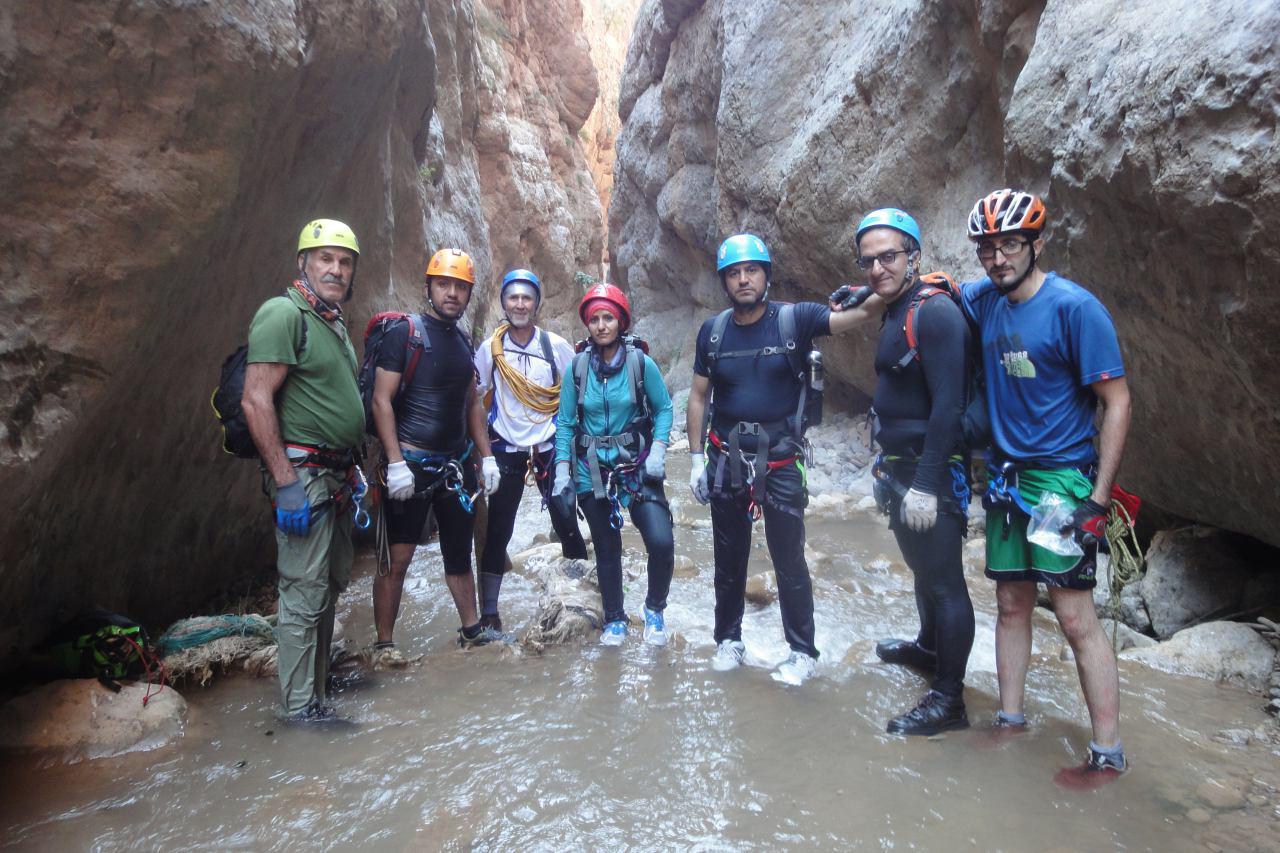
Yes, there are numerous guided tours available, which provide safety equipment and expert guidance, ideal for both beginners and experienced canyoners looking to explore Iran’s rugged terrains safely.
What is the best time of year to go canyoning in Iran?
The best time for canyoning in Iran is typically from late spring to early fall, when the weather is milder and the water levels in the canyons are more manageable.
What should I pack for a canyoning trip in Iran?
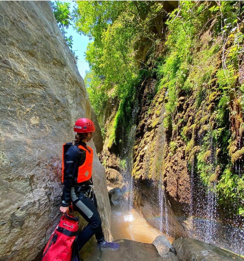
Essential canyoning gear includes a helmet, wetsuit, proper footwear, harness, ropes, and carabiners. It’s also advisable to bring a waterproof bag for personal items and a first aid kit.
How do I ensure my safety while canyoning in Iran?
Always canyon with a guide or an experienced group, check the weather conditions before heading out, use proper safety gear, and ensure you have local emergency numbers on hand.
Frequently Asked Questions: Canyoning in Iran
From Novice to Pro: A Guide to Iran's Canyons Based on Difficulty
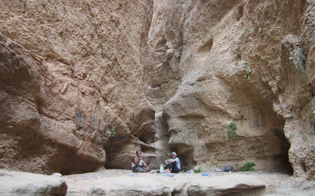
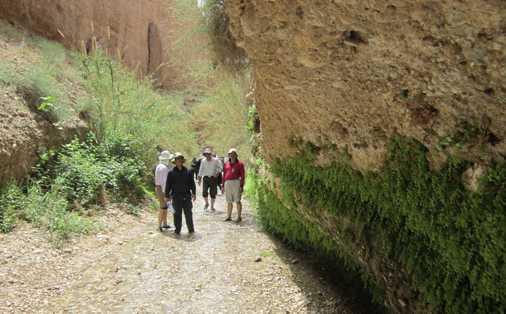
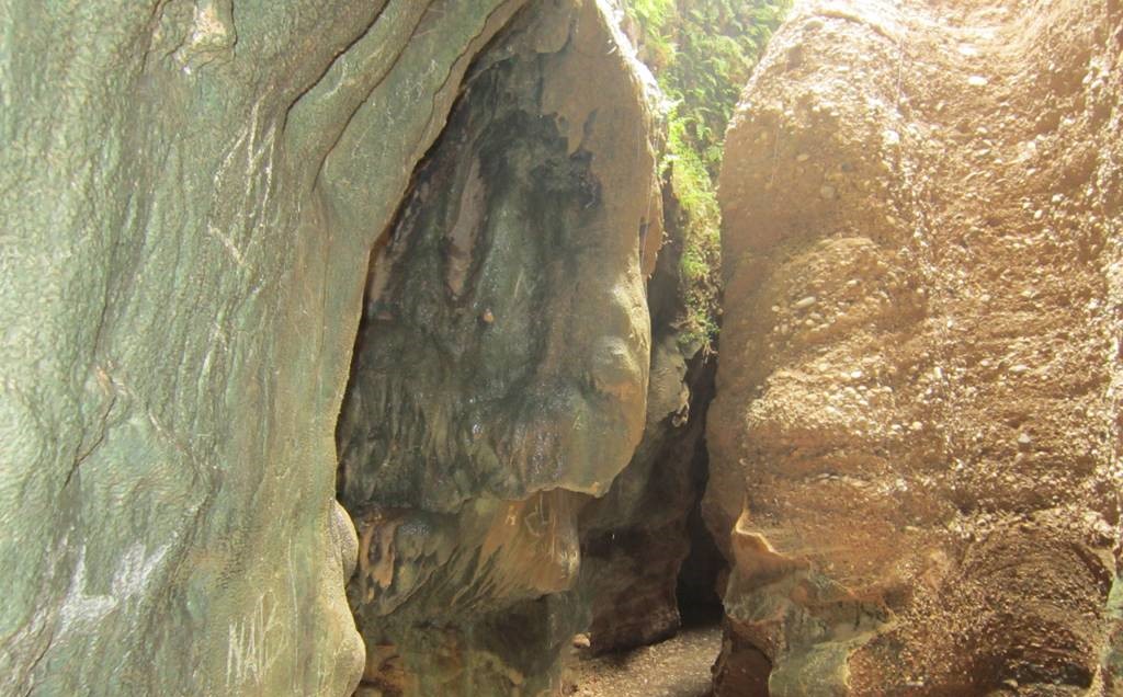
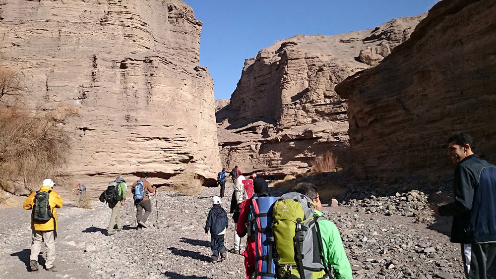
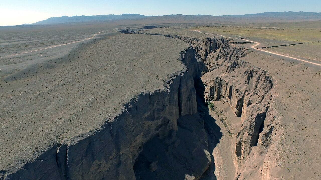
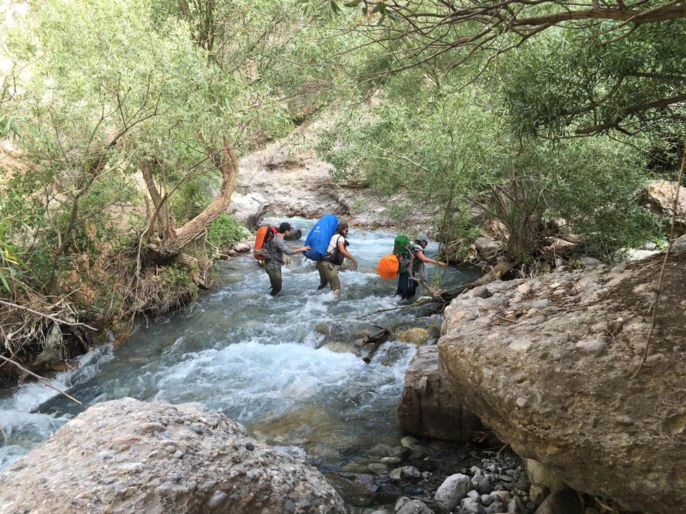
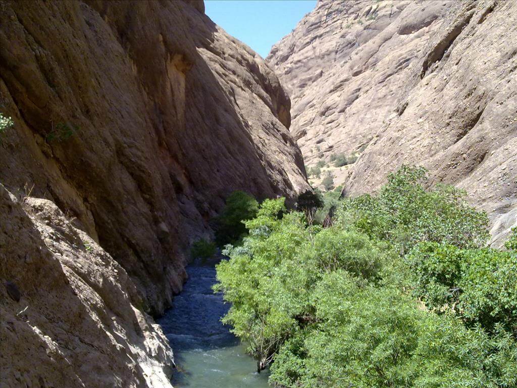
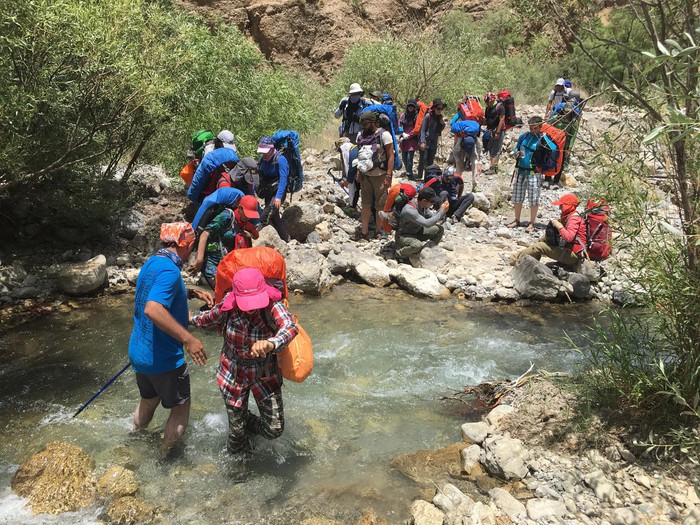
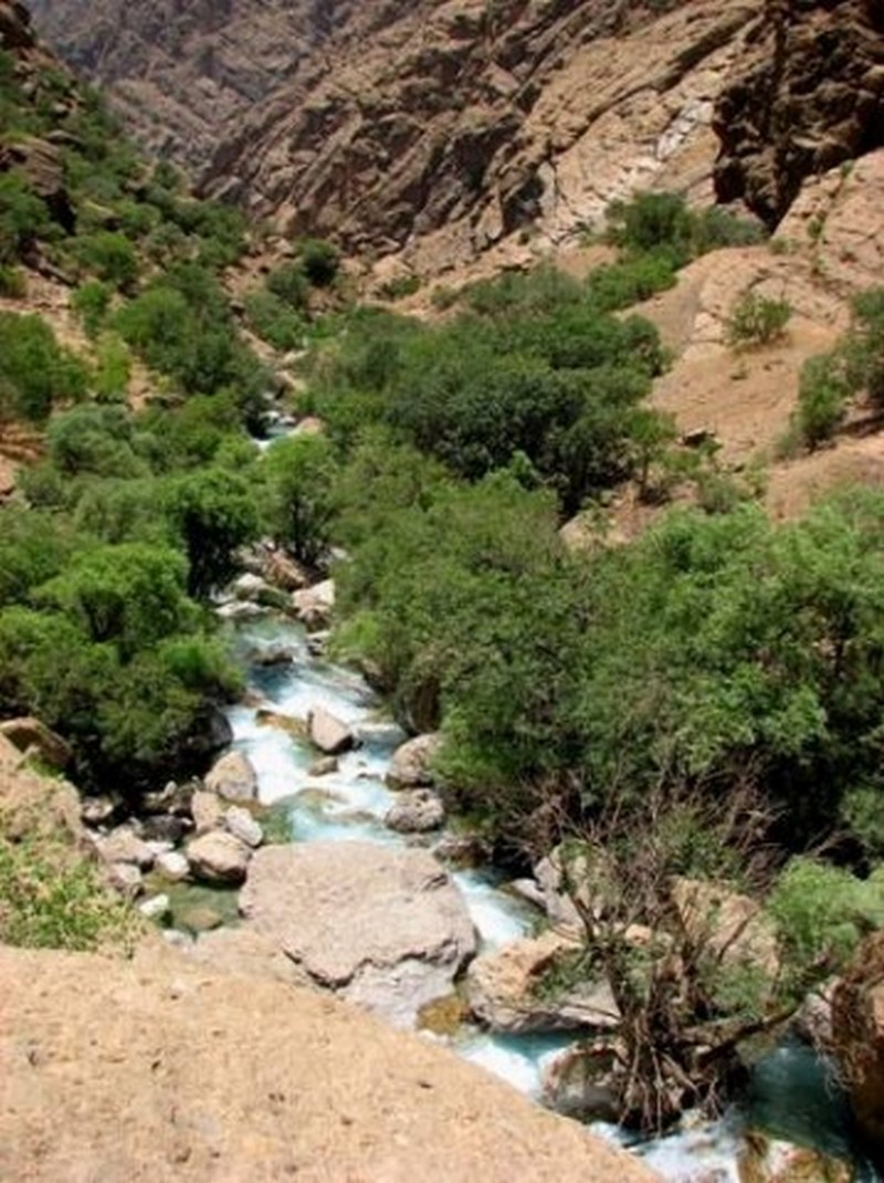
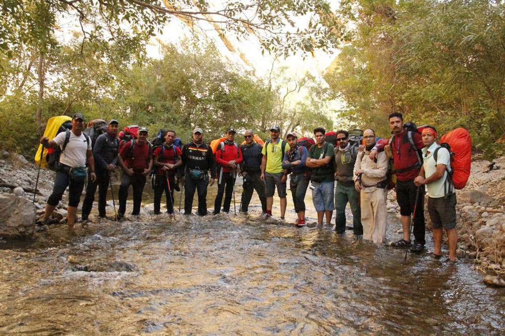
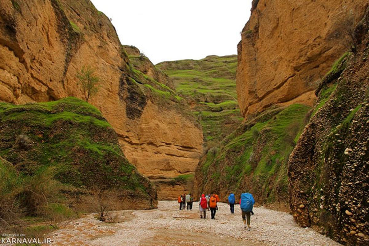
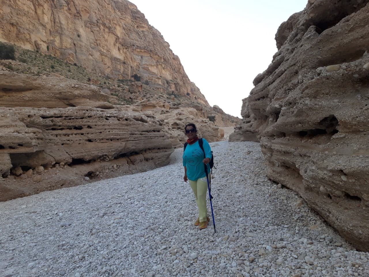
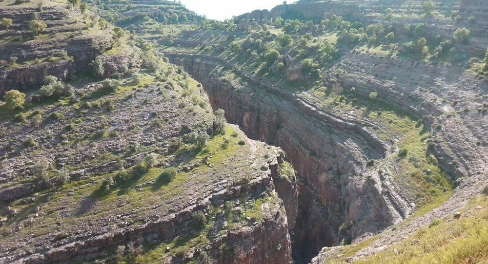
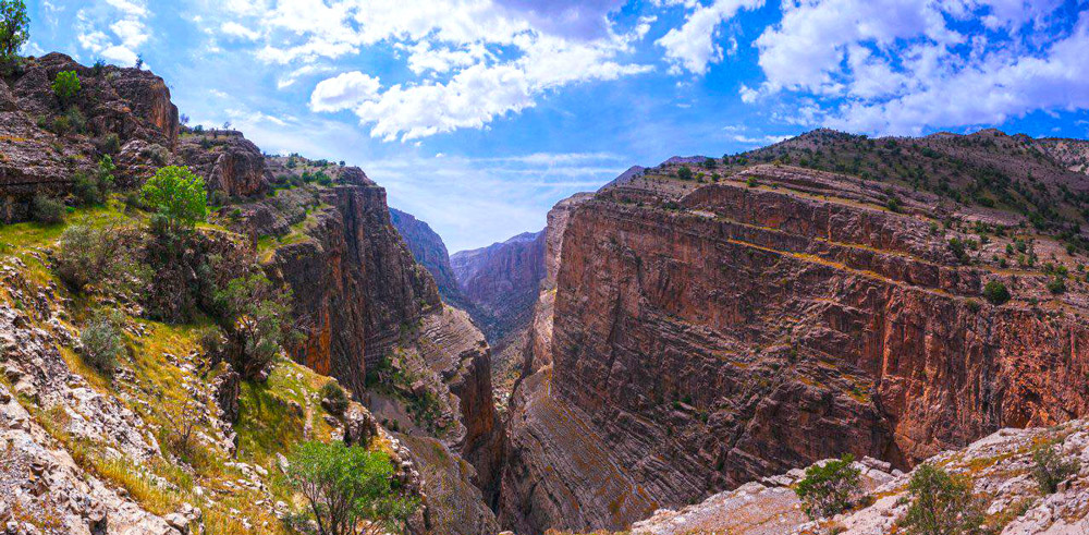
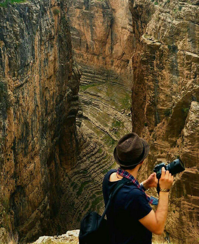
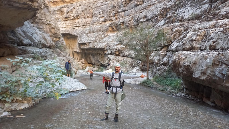
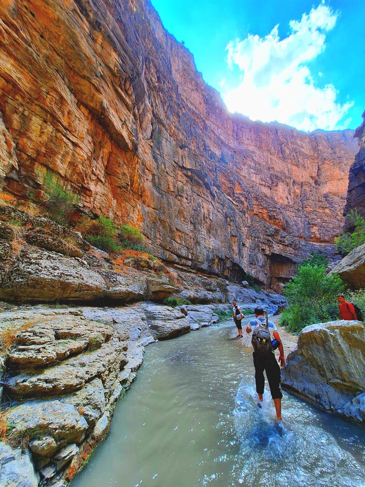
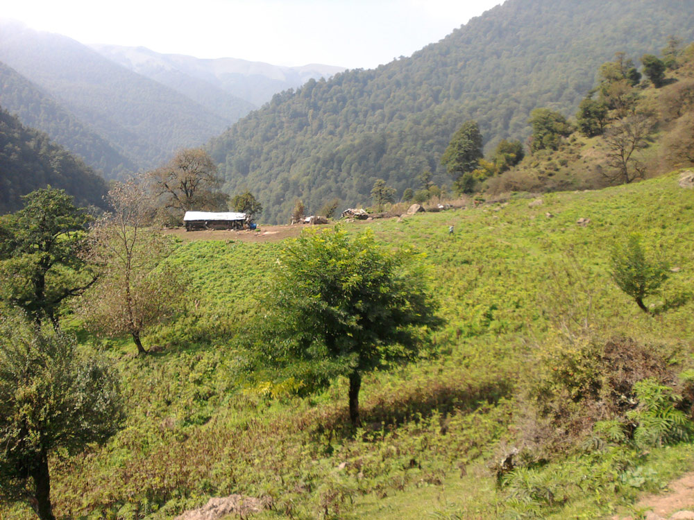
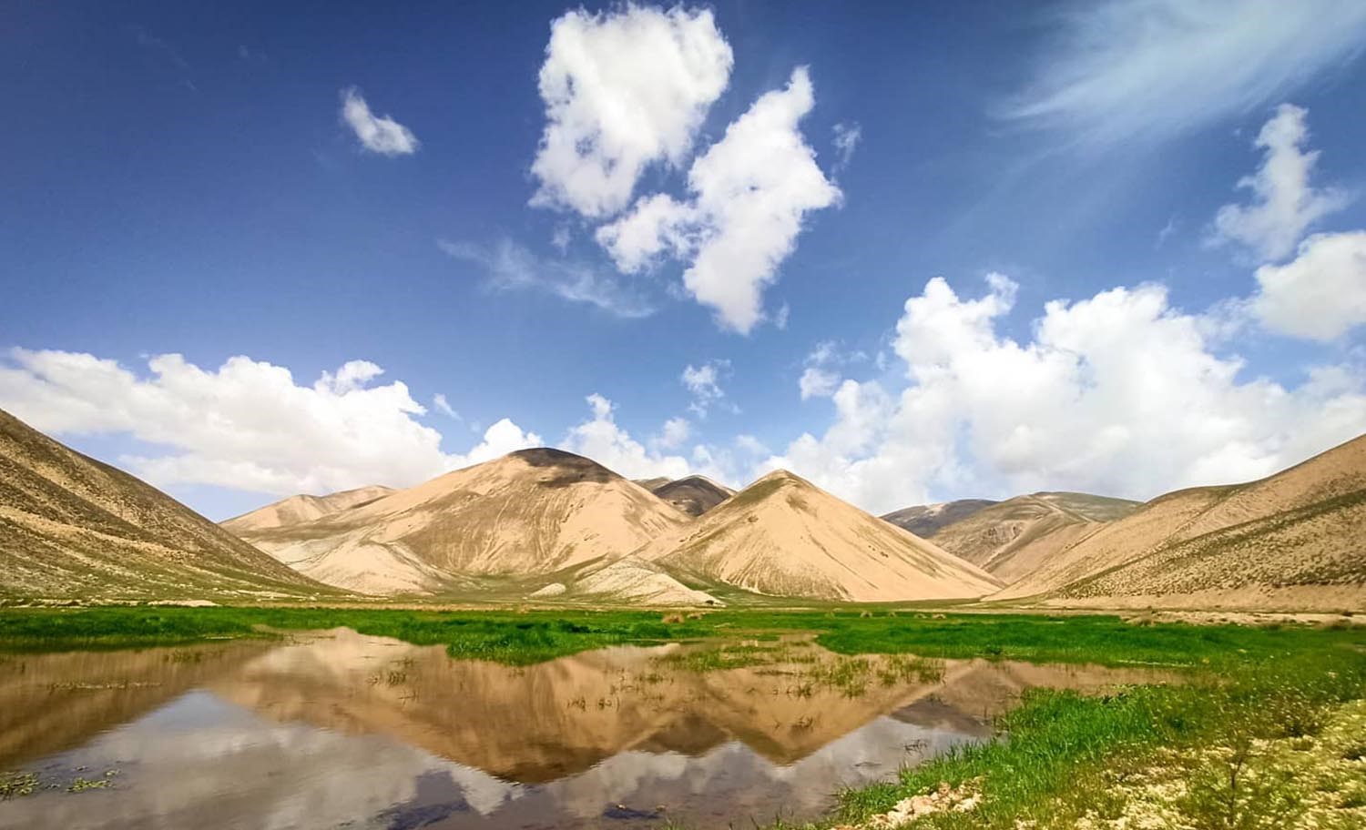
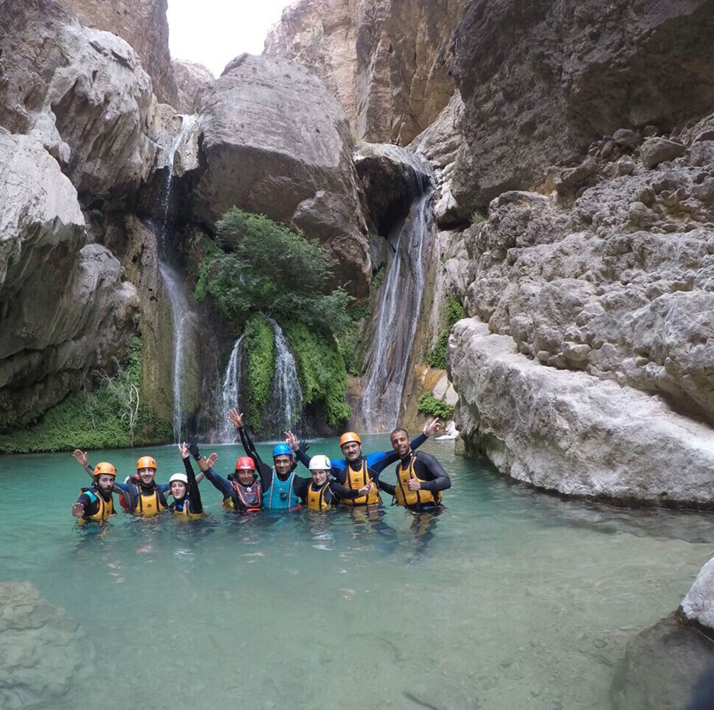
Canyoning destinations in Iran are scattered across various parts of the country, from the north to the south. They are trendy among canyoning enthusiasts and mountaineers interested in this sport. Canyoning is a branch of mountaineering that has been practiced for a long time, with various purposes and has a lengthy history. Currently, canyoning is considered one of the most challenging sports. However, many mountaineers are eager to advance in rugged mountain terrains and discover different canyons in Iran and other parts of the world. The extensive mountain coverage in many provinces of Iran has led to the formation of winding canyons throughout the country. Canyoning spots in Iran are located in various mountains from the north, northwest, and northeast to the central and southernmost parts of the country. The canyons in Iran are among the best destinations for nature tourism. This article introduces famous canyons in Iran, ranked by their difficulty levels. The difficulty of navigating these canyons is measured based on the experience of professional and seasoned canyoners.
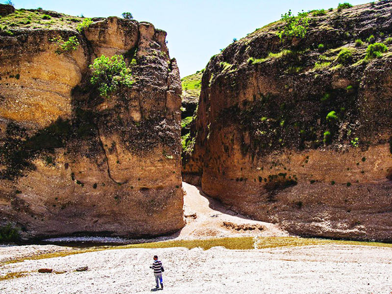
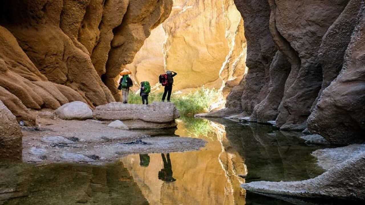
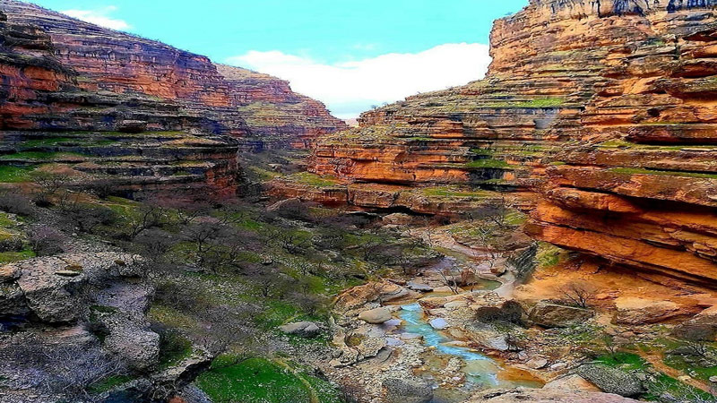
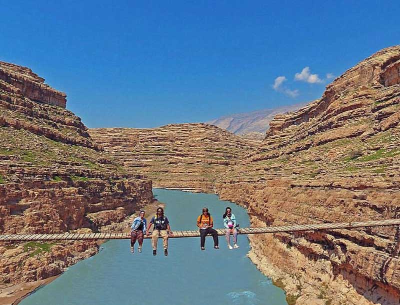
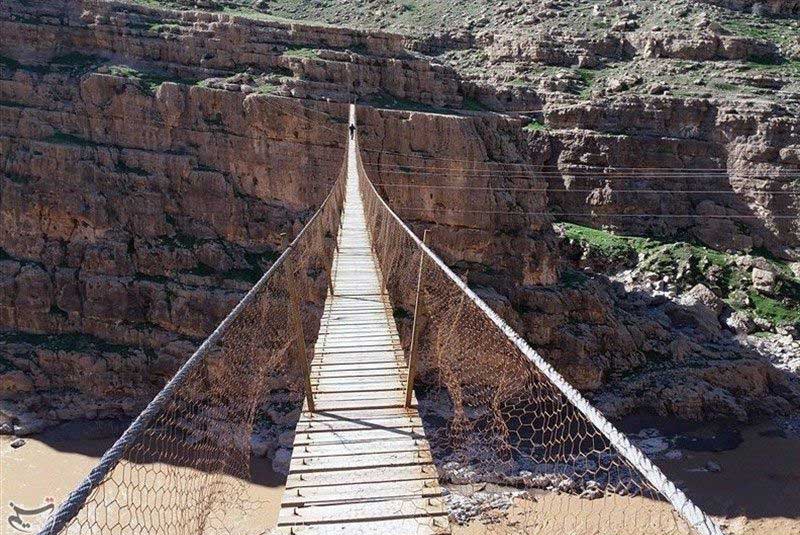
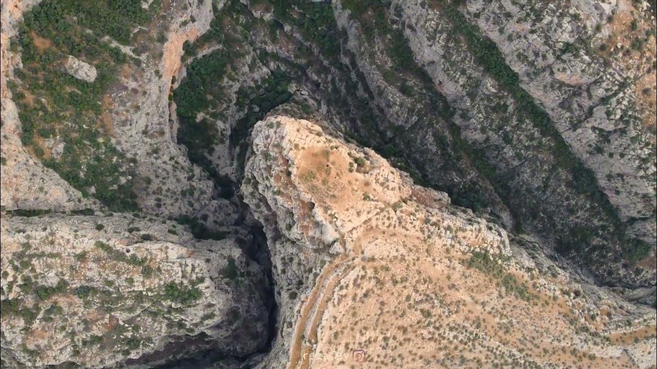
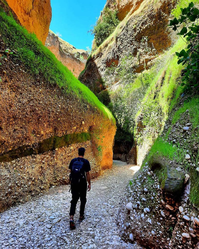
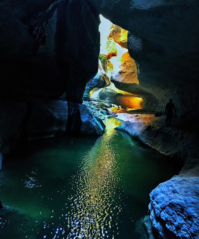
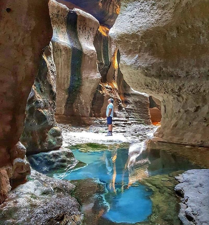
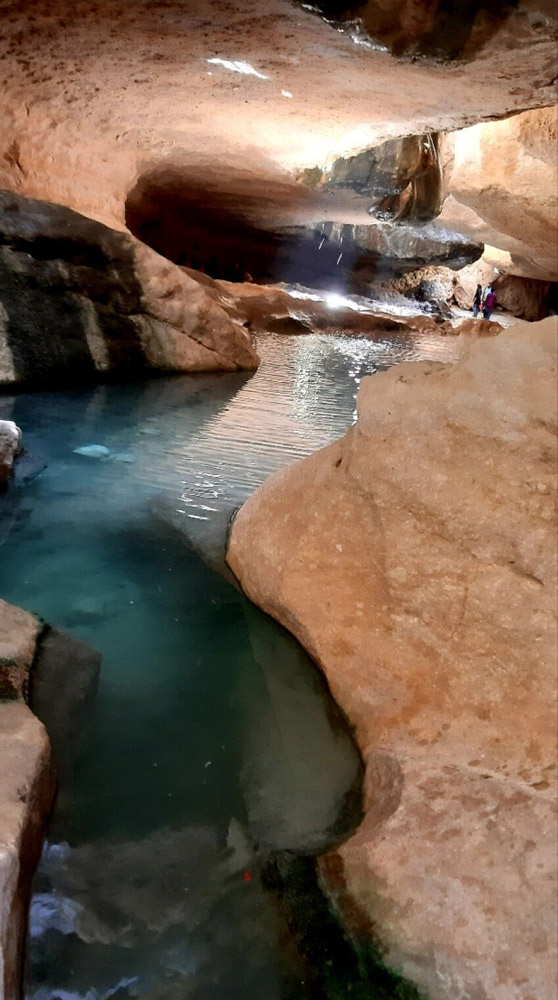
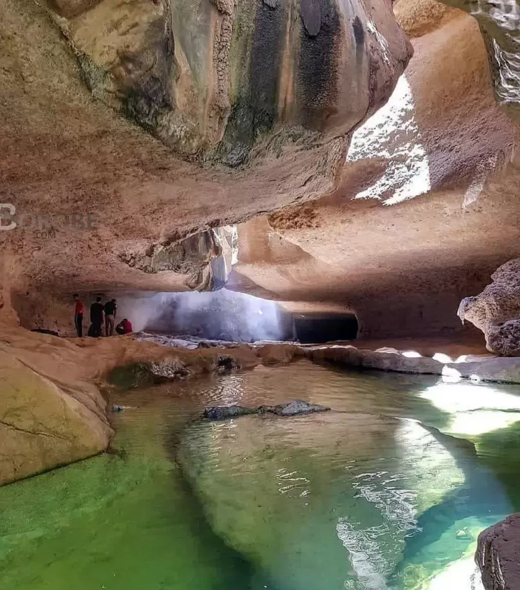
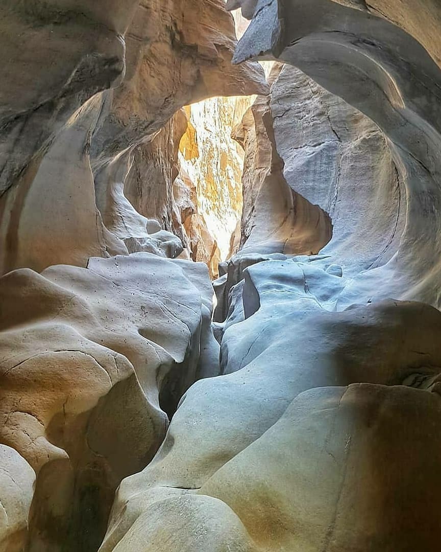
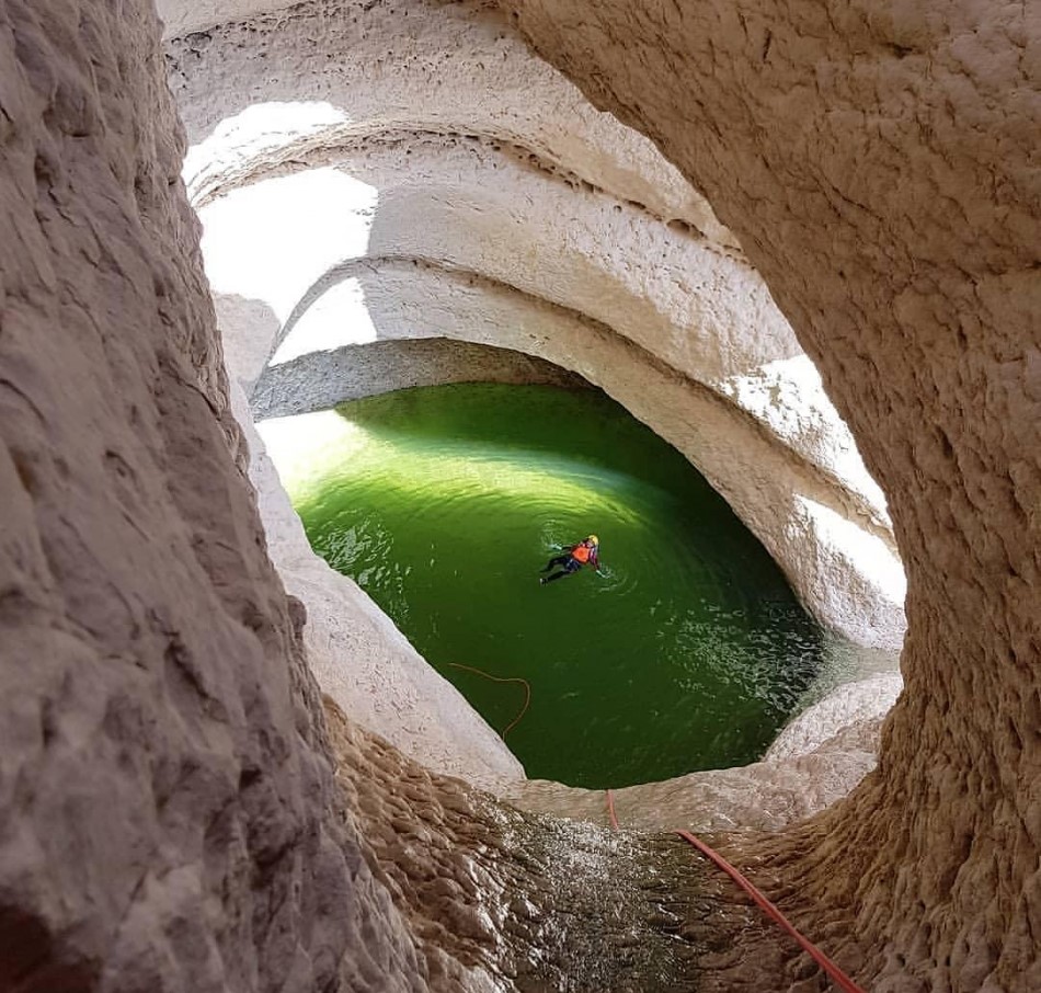
Zingan Canyon
- Difficulty Level: Easy
- Approximate Path Length: Five kilometers, over one kilometer within the gorge
- Estimated Hiking Time: One-day itinerary
- Best Time to Visit: Spring season
- Geographical Location: N33.2614 | E46.0939
- Address: Northwest of Ilam province, Mehran County, Salehabad
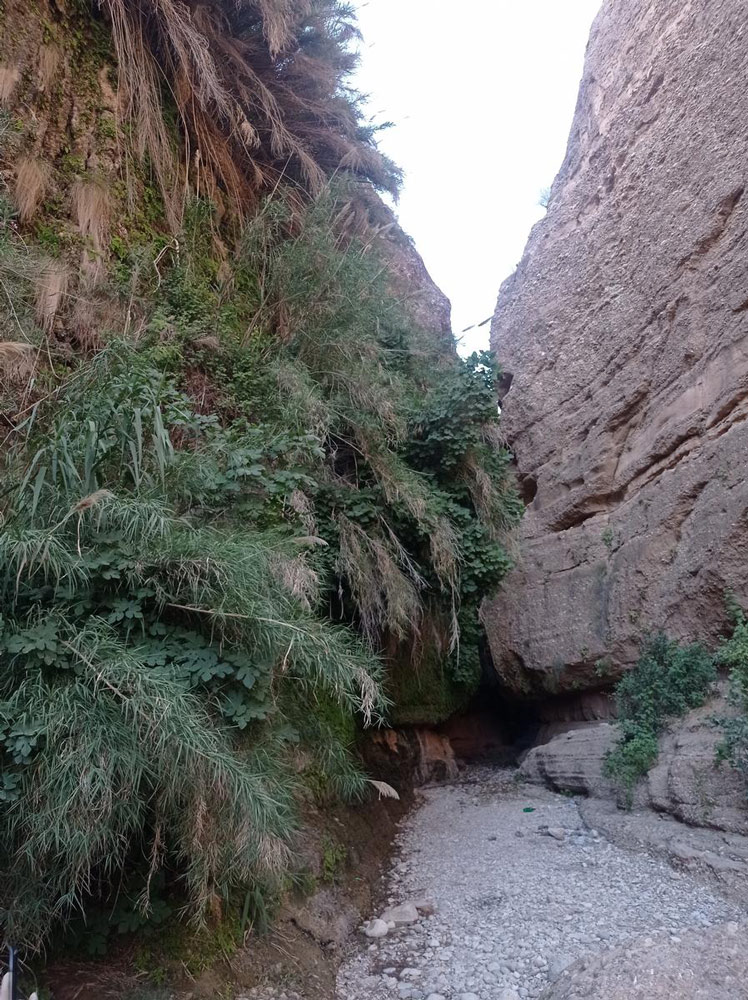
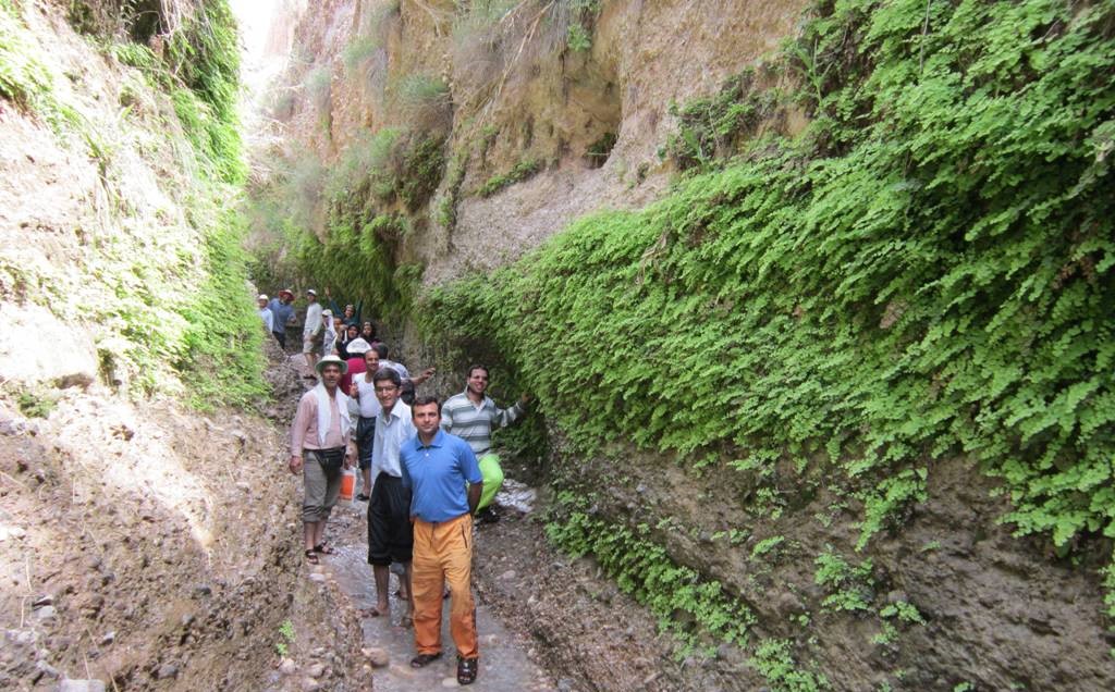
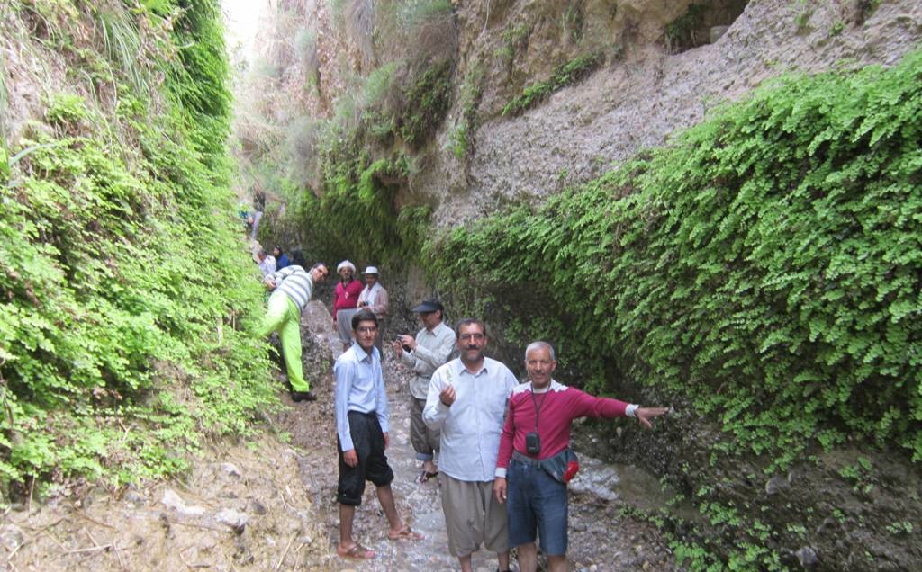
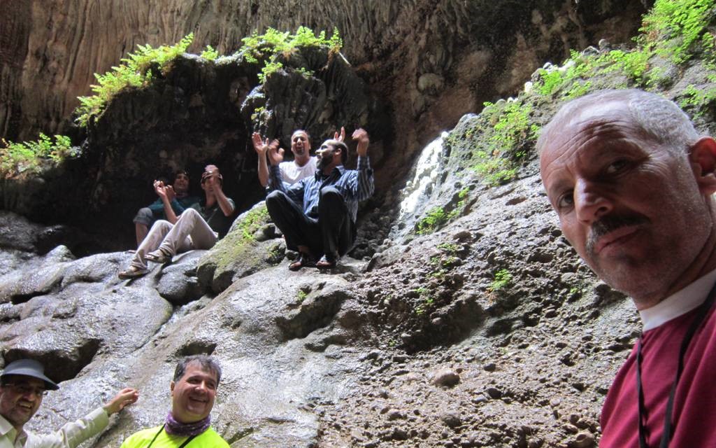
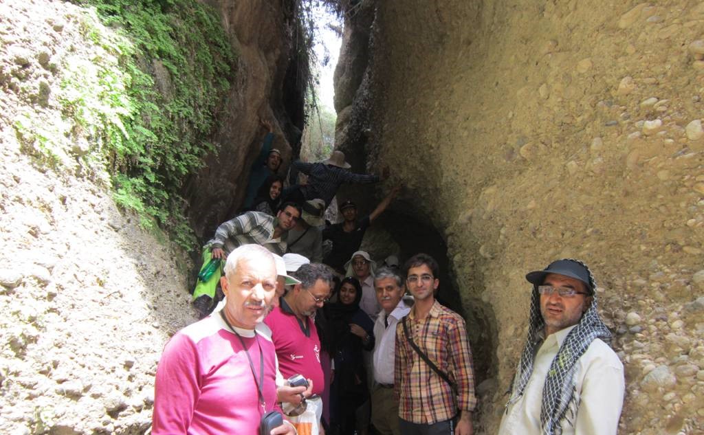
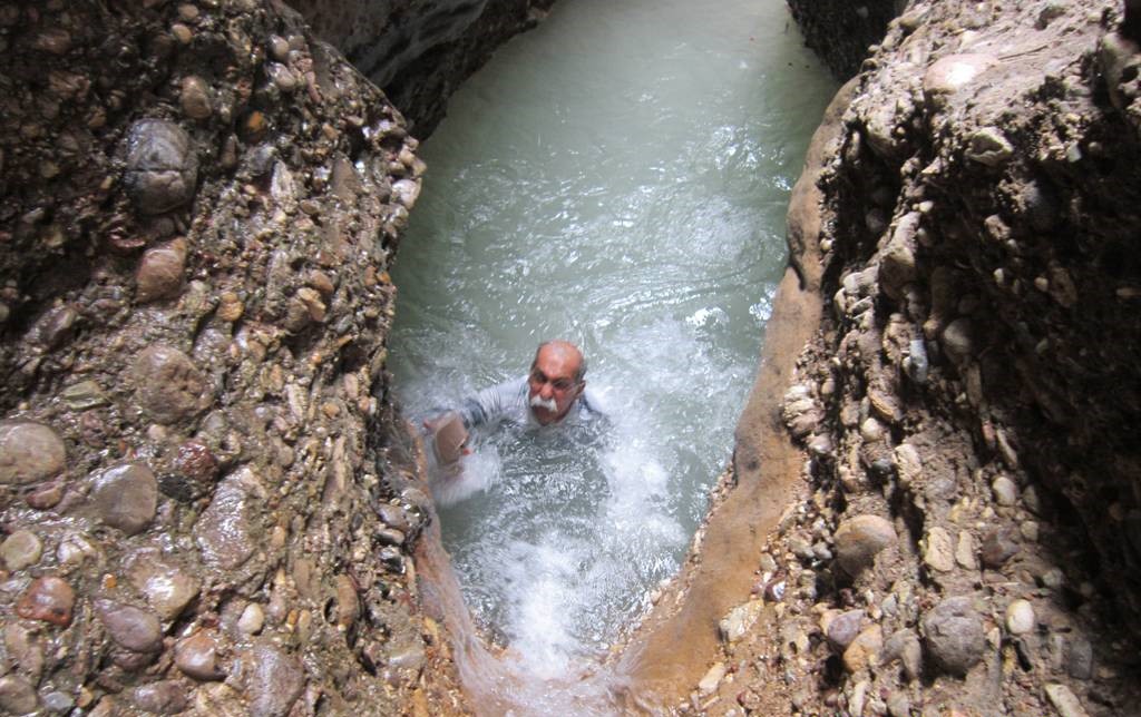
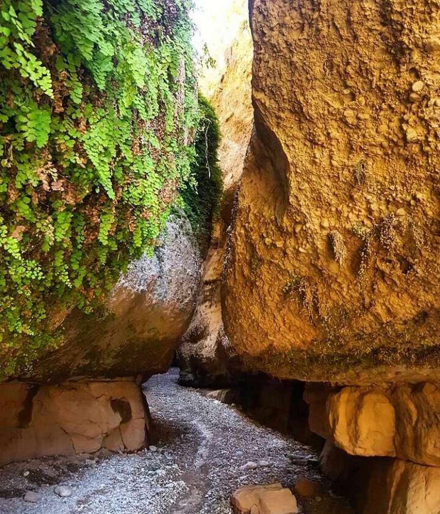
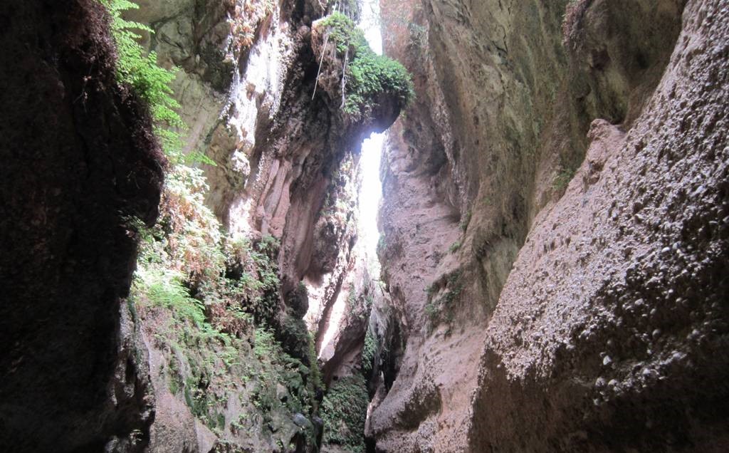
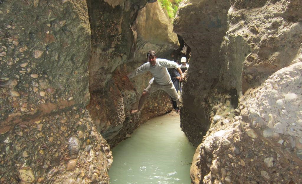
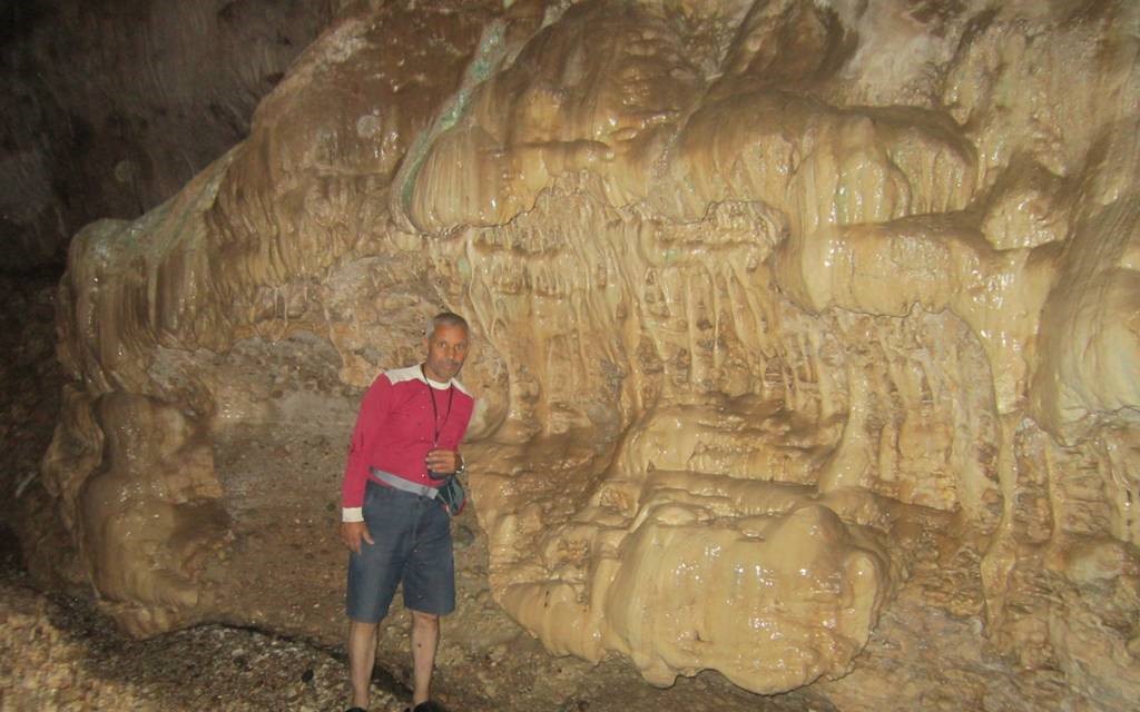
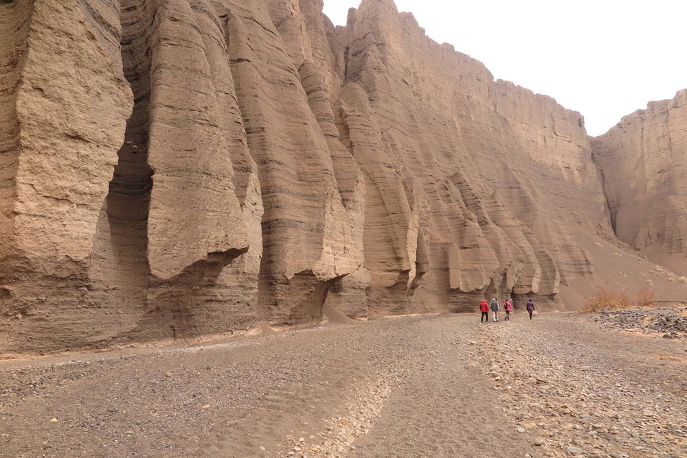
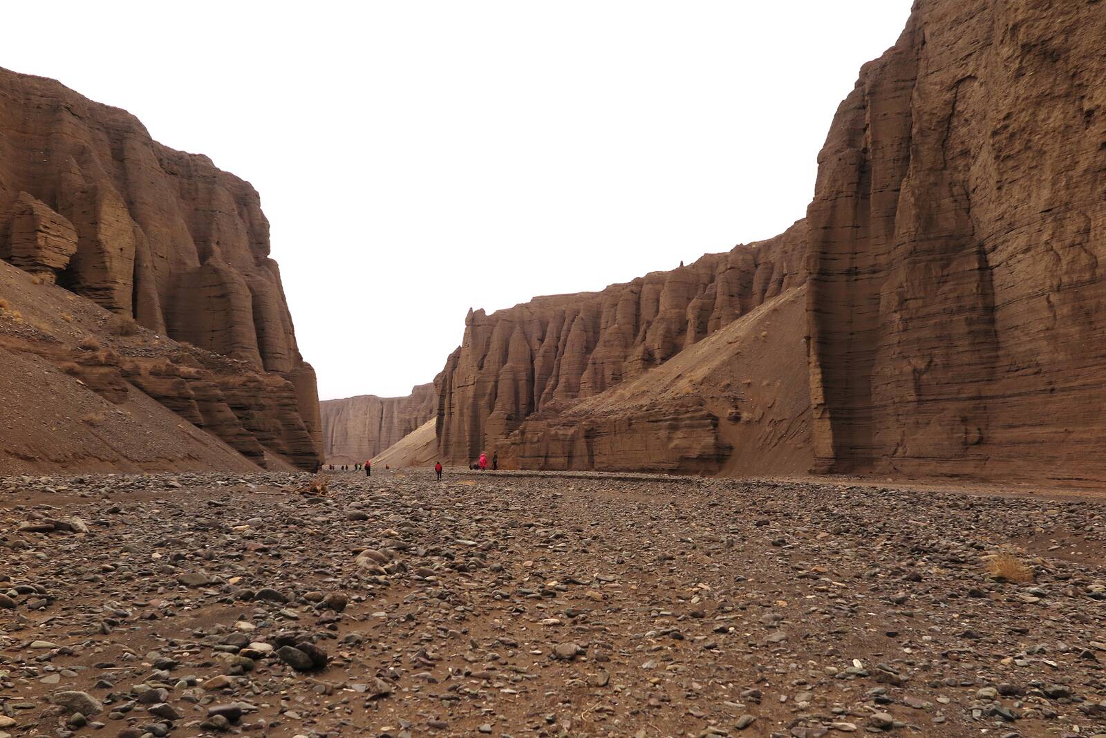
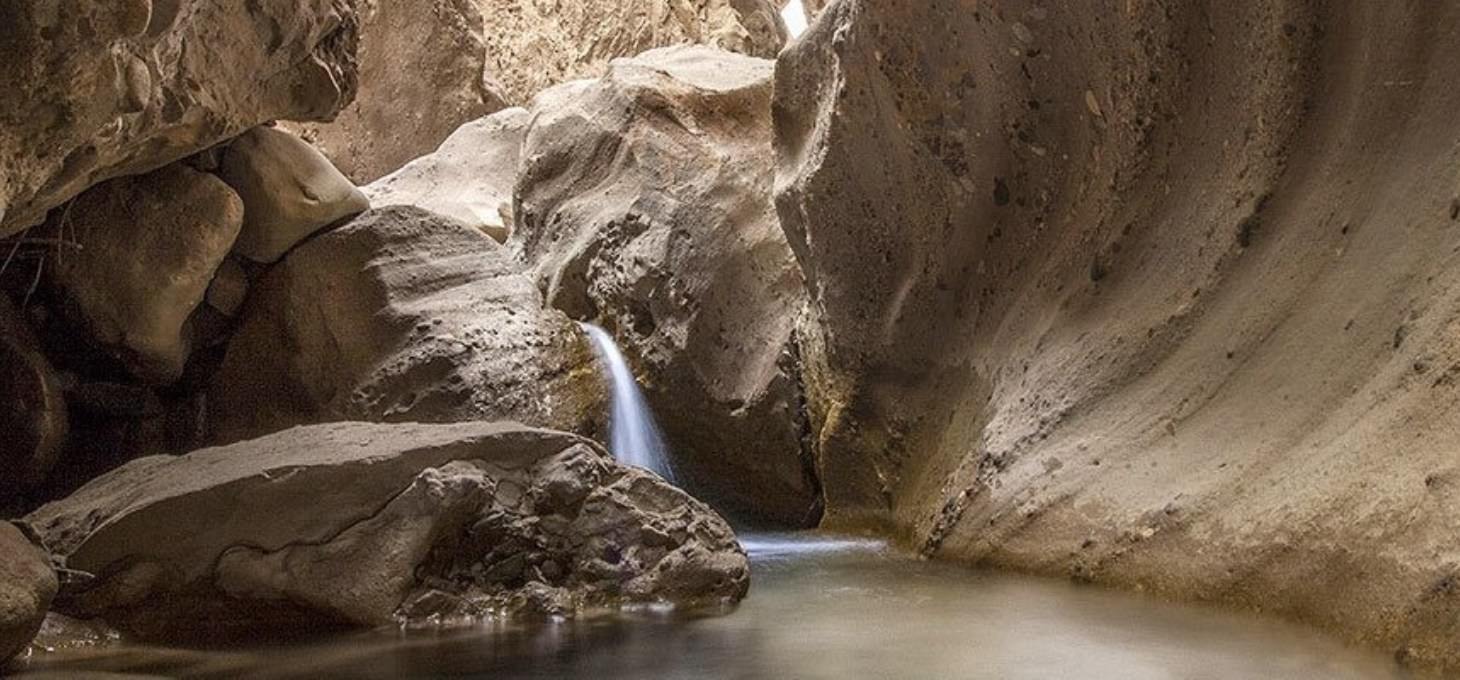
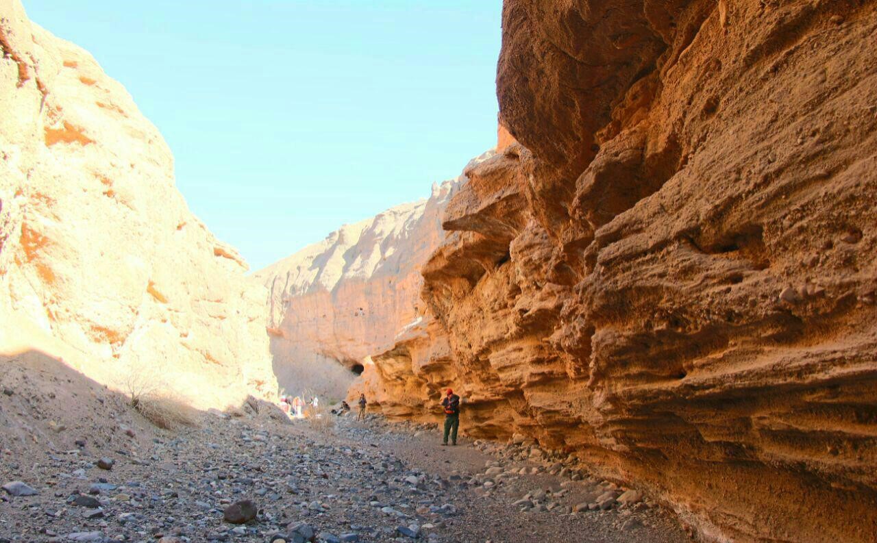
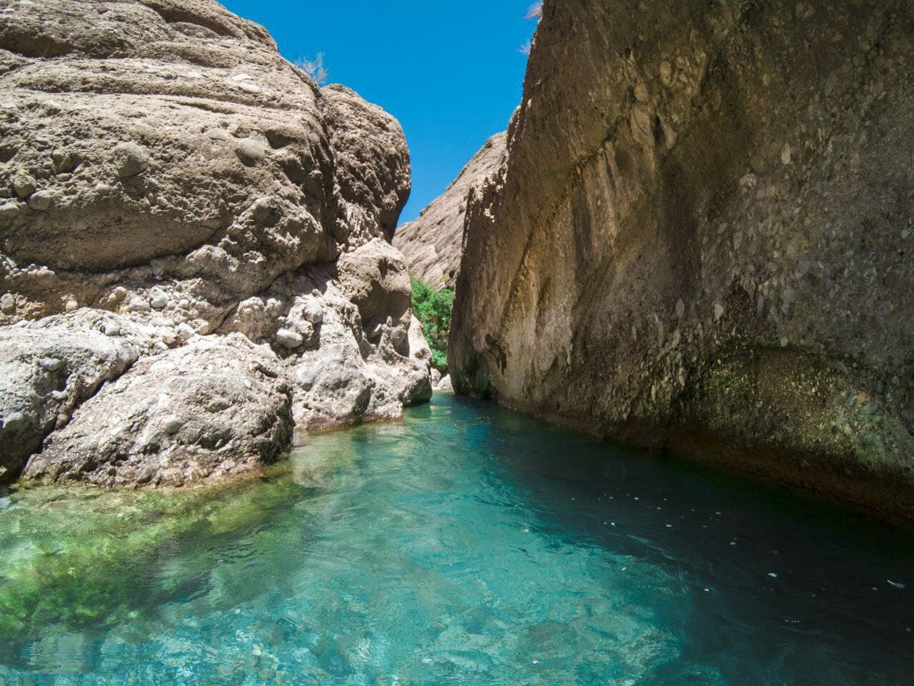
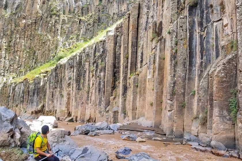
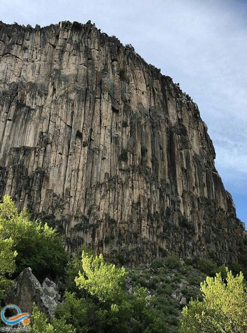
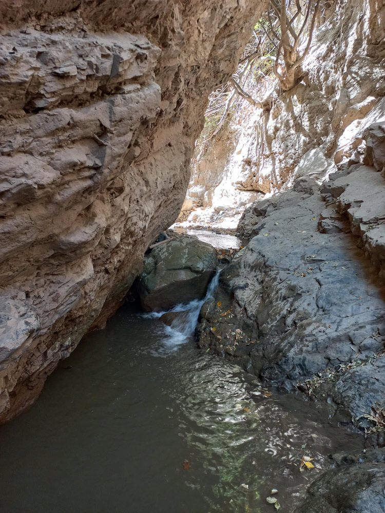
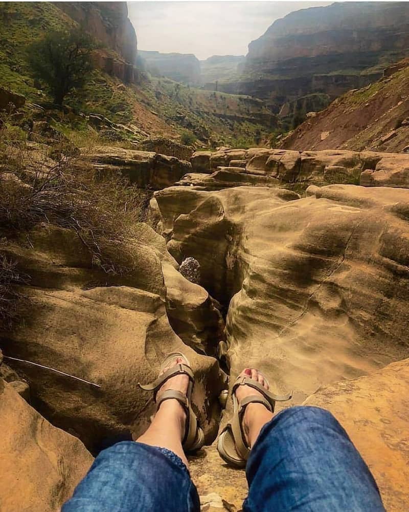
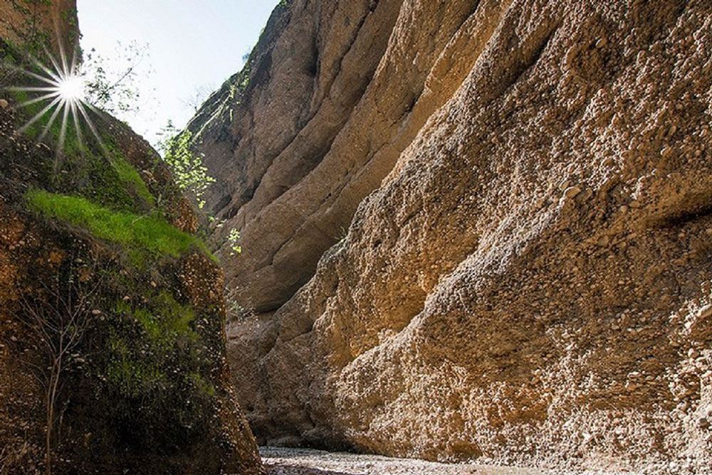
Zingan Canyon is located in Ilam province, near the village of Salehabad. It’s known among the locals as “Zingan Cave.” The canyon’s structure has led the locals to refer to it as a cave. Situated in the Zagros Mountains, Zingan Canyon was formed over many years due to water erosion along one of the branches of the “Cham Sorkh” river.
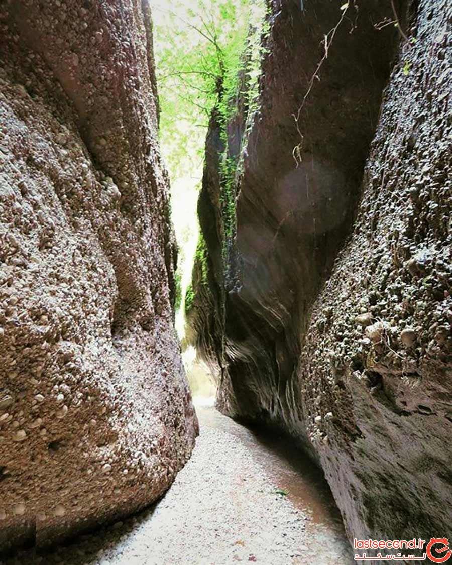
Zingan Canyon is close to the “Koolk” protected area. Its width varies between two to eight meters, and its length is debated as one to five kilometers. The canyon walls in some places reach a height of 30 meters. In certain parts, the canyon walls resemble indented corridors, giving them a cave-like appearance.
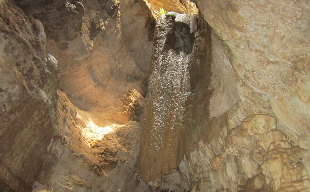
The walls of Zingan Canyon are stratified, with beautiful rock formations hanging along the path. A continuous water flow along the walls creates a humid atmosphere throughout the canyon. The middle fissures of the canyon are very narrow, requiring individual passage. One of the main attractions of Zingan Canyon is the two waterfalls along the path.
The best time to visit Zingan Canyon is during the spring season. Although the temperature inside the canyon is more moderate than its surroundings throughout the year, the nearby areas can become very hot in the summer and cold in the winter. There’s also a risk of flash floods in the canyon during autumn, so visiting during sunny, rain-free days in spring is recommended.
It’s not feasible to stay overnight inside Zingan Canyon due to its damp and enclosed environment, making it unsuitable for camping. Bring all the necessary camping equipment if you’re looking to camp in the surrounding areas. There are opportunities to stay in local guesthouses and homestays in nearby villages and towns. The dirt road from Allahabad village to Zingan Canyon is about five kilometers long.
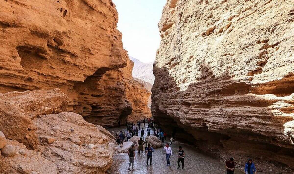
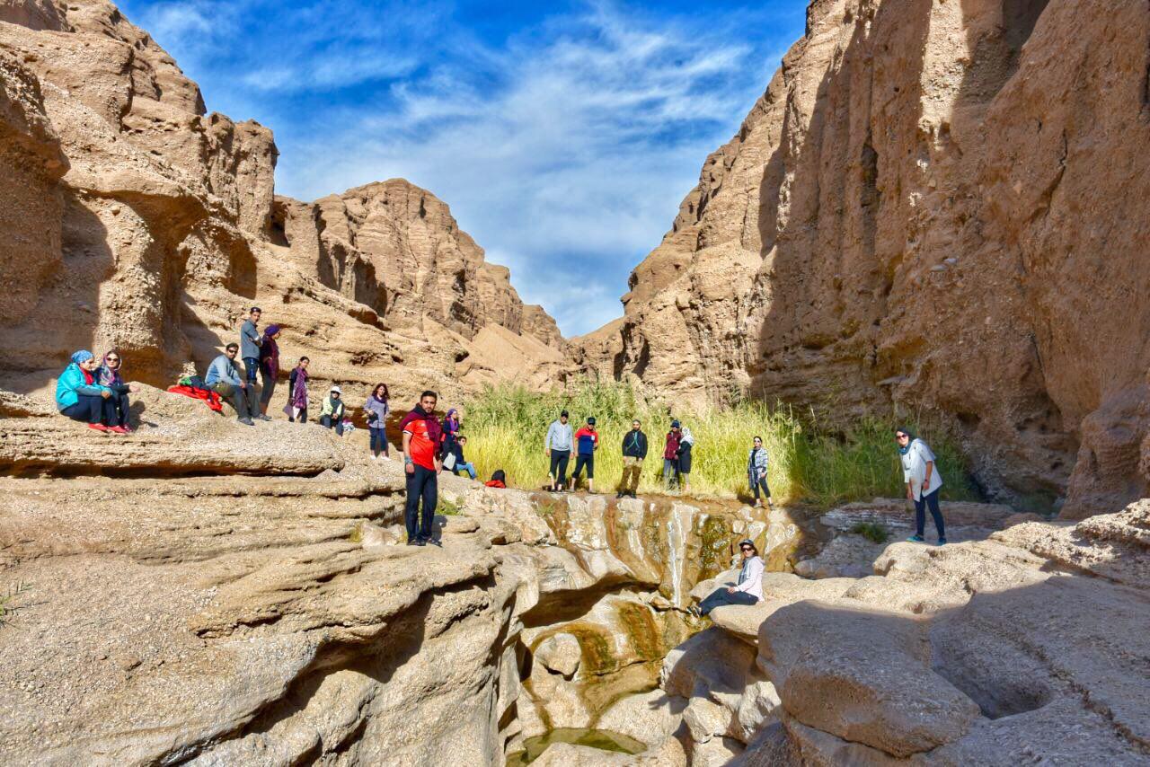
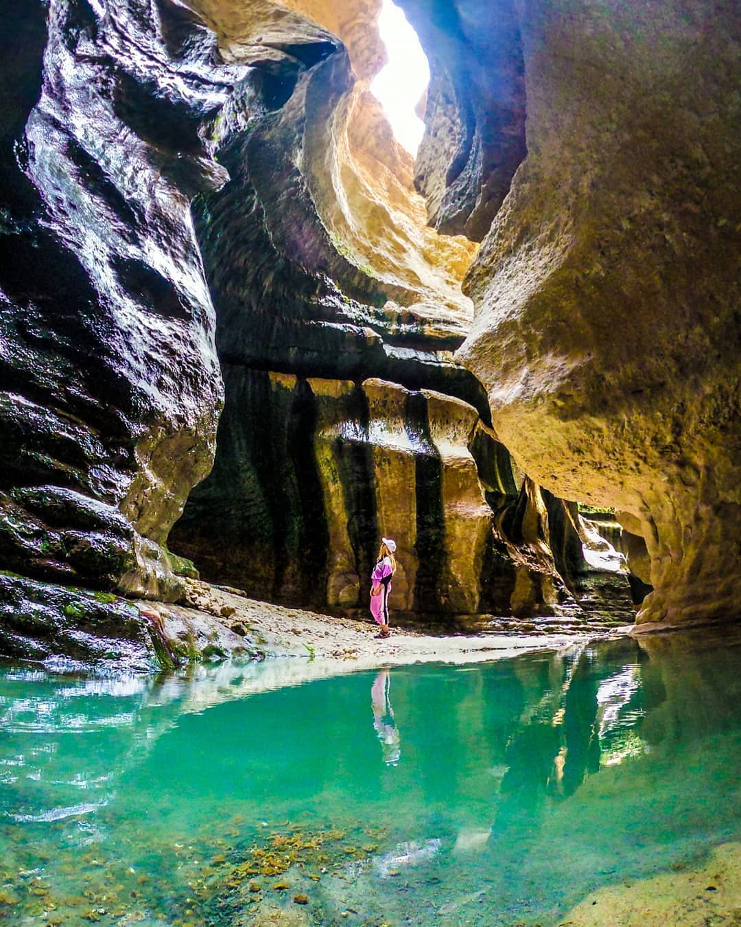
Rageh Valley
- Difficulty Level: Easy
- Approximate Length: 20 kilometers
- Approximate Trek Duration: One-day program
- Best Time to Visit: Spring and Fall seasons
- Geographic Location: N30°08’13” | E56°09’26”
- Address: Northwest of Kerman province, Southeast of Rafsanjan city, Badooyeh Protected Area
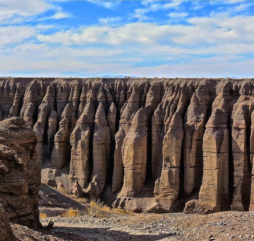
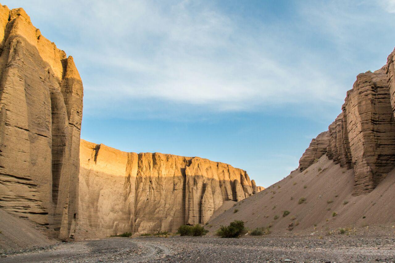
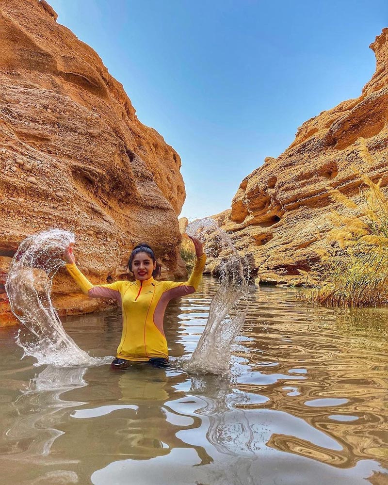
The Rageh Valley near Rafsanjan is close to the central desert of Iran. It is among the most beautiful canyon trekking routes, also standing as the third geopark in Iran. This valley is a short distance from Rafsanjan, and a one-day visit is feasible. The Rageh Valley is recognized by its tall, stacked walls formed over time due to erosion caused by water flow. Currently, the “Gyodri” river flows through this region, and numerous springs are scattered throughout various parts of it.
The depth of the Rageh Valley is approximately 70 to 80 meters, and it extends about 20 kilometers. The width between the walls of this valley is around 180 meters and varies in certain sections. Erosion in the rocks throughout the Rageh Valley continues, and various parts change shape throughout the year.
The approximate area of the Rageh Valley is around 36,000 hectares, and it dates back to the fourth geological period, which means it’s more than 20,000 years old. This valley is a short distance from the Badooyeh Protected Area of Kerman, which is the habitat of a specific species of deer in Iran. The suitable geographical location of the Rageh Valley has led to various animal species inhabiting it, notable examples being eagles, drakes, and partridges.
For accommodations in the Rageh Valley, you should bring complete camping equipment. The valley remains untouched; however, an eco-camp equipped with various recreational and housing facilities is under construction near the valley. To visit the Rageh Valley, follow the tourist path of the villages of Meymand and Kalut Shahdad, southeast of Rafsanjan. The valley is located about 30 kilometers from the city of Rafsanjan. The local road to the Rageh Valley is asphalted, with only the final section unpaved.
The best time to visit the Rageh Valley, considering this region’s hot and dry climate, is during the spring and fall seasons. However, it’s not advisable to see the valley during rainy times, as the structure of the valley’s walls during desert rains can cause flooding. Trekking the Rageh Valley is suitable for all canyon touring enthusiasts, but it’s essential to seek assistance from local guides when entering the area.
Kal Jenni Valley
- Difficulty Level: Easy
- Approximate Length: 8 kilometers
- Estimated Duration: One-day plan
- Best Time to Visit: Spring and Autumn seasons
- Geographical Location: N33.4927 | E56.4954
- Address: Northwest of South Khorasan province, Tabas city, Azmighan village
Kal Jenni Valley is located near Tabas and the picturesque village of Azmighan. The valley and the town are among the most scenic spots in South Khorasan province. Over many years, the Kal Jenni Valley was formed due to soil erosion in this region along the path of the Azmighan River. This river originates from the “Shetri” mountain range to the north of Tabas and continues on a steep path to the plains of Tabas.
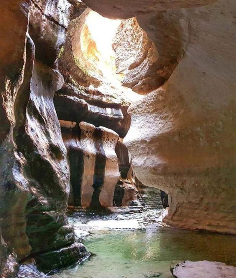
The Kal Jenni Valley has sunken and protruding rocks with numerous holes and grooves, among which small and large waterfalls flow. The walls of this valley are terraced in some parts, and pools of water can be seen under these walls along the path. “Kal” in the local language means an erosional way in a flood route, and “Jenni” has mythical roots. The locals named it due to the eerie sounds of wind twisting through the valley.
Kal Jenni Valley is serpentine-shaped and eventually leads to the qanats and the plains of Tabas. The first three kilometers of this valley are limestone, and the most beautiful rocks are located in its middle two kilometers. The final three kilometers of the Kal Jenni Valley are covered with sedimentary deposits. This gorge is known as “Jenni Valley” in Iran’s natural heritage list.
Kal Jenni Valley is wholly pristine and without amenities. Nature enthusiasts can camp in the interior parts of this valley. Due to the outstanding tourism potential of the area, the village of Azmighan offers various local lodging options.
Kal Jenni Valley is close to a desert area, and there is a significant temperature difference between day and night in this valley. The best time to visit is the early days of the spring and autumn seasons. As summer and winter approach, the weather in the Kal Jenni Valley becomes scorching and cold, respectively. To access this valley from Tabas, you can head towards the city of Eshq Abad or the village of Azmighan. Azmighan is located approximately 26 kilometers north of Tabas, and the entrance to the Kal Jenni Valley is along the same road, about 9 kilometers from this village.
Shirzar Valley
- Difficulty Level: Easy
- Approximate Route Length: 5 kilometers
- Estimated Duration: One-day trip
- Best Time to Visit: From the early days of spring to the early days of summer
- Geographical Location: N33.848 | E47.3122
- Address: Northwest of Lorestan Province, Kouhdasht County, Oulad Qaba Road
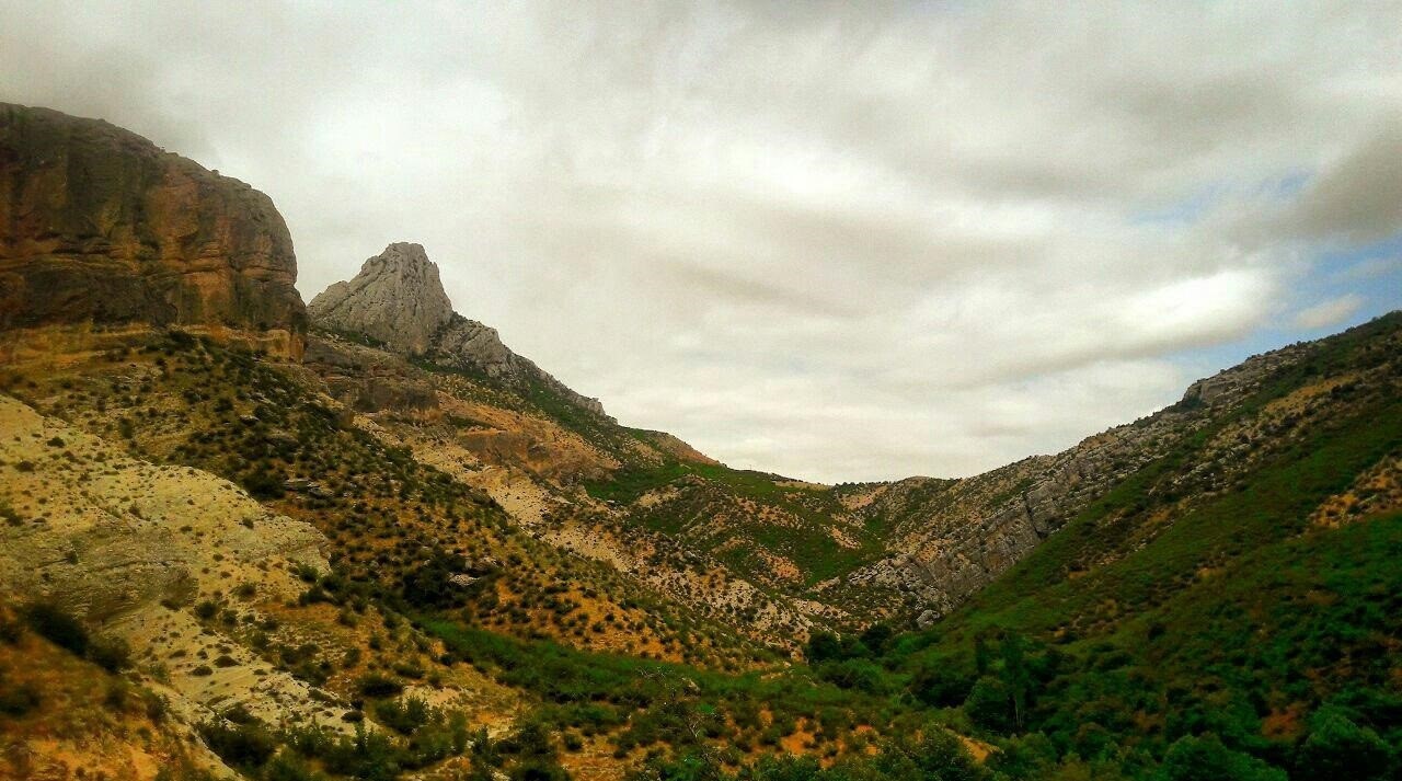
The Shirzar Valley in Lorestan is one of the most beautiful valleys in Iran, situated on the border between Ilam and Lorestan provinces, near Kouhdasht. This gorge spans approximately 5 kilometers and is next to the Simreh River. Mountain rocks rise 150 to 200 meters along the Shirzar gorge. As you progress through the canyon, the slope of the valley walls becomes steeper.
The Shirzar Valley is millions of years old, and its stratified rock structure has developed over many years due to water and soil erosion. In parts of Shirzar Valley, the rocky corridors become winding and convoluted, and these sections are often referred to as the most beautiful parts of the valley. Shirzar Valley is a natural geopark in western Iran, with few comparable examples found worldwide.
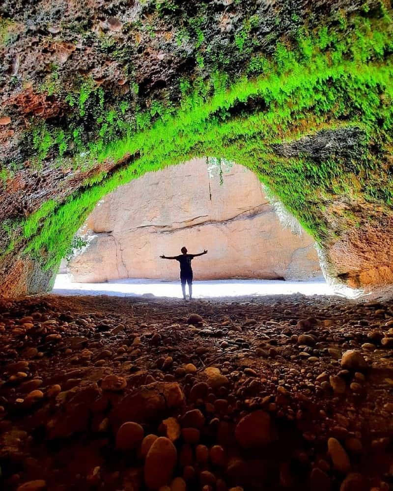
The highest point along the Shirzar Valley route reaches over 1,100 meters above sea level. Some of the main attractions of this valley include the Shirzar Waterfall, also known as the Birds’ Waterfall, the “Shirzar Minaret,” and the “God’s Bridge” cave. The entire valley is covered with a diverse vegetation of plum trees, oaks, fig trees, and various herbaceous species. The Shirzar Valley is recognized as a “National Geosite” on Iran’s natural heritage list.
The Shirzar Valley remains largely untouched. If you plan to stay overnight, you must bring all the necessary camping equipment. There are also various local accommodations available in the surrounding villages. For hotel and guesthouse stays, you can head to Kouhdasht County. The best time to visit Shirzar Valley is from the beginning of spring to the end of the season. During summer, the weather in the region becomes hot. Due to heavy rainfall in the autumn and winter and the risk of flooding in the Shirzar Gorge, it’s not advisable to visit during the latter half of the year. To visit Shirzar Valley, you should head to Kouhdasht in the western part of Lorestan Province. The Oulad Qaba Road north of Kouhdasht leads to the Simreh River and Shirzar Gorge. The side road to this valley is paved, turning to dirt only in the last two kilometers.
Neygaah Valley
- Difficulty Level: Medium
- Approximate Length of the Route: 18 kilometers
- Approximate Duration of the Trek: Two-day itinerary
- Best Time to Visit: From the last days of spring to the first days of autumn
- Geographical Location: N33.2743 | E46.2133
- Address: East of Lorestan province, Dorud county, Eshterankooh protected area
Neygaah Valley, located near Khorramabad and Dorud in Lorestan province, is among Iran’s most temperate and lush valleys. The valley is named “Neygaah” due to abundant reeds throughout its length. The width of the trekking path in this valley is close to 500 meters, and various plant species can be seen throughout. The Iranian oak, mountain cypress, wild almond, and mountain mushrooms form most of the valley’s vegetation.
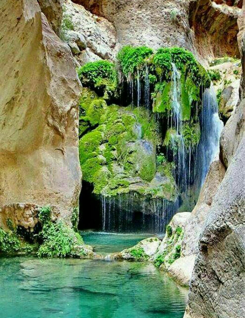
The White Water River flows through Neygaah Valley, and along its course, other streams pour into it, ensuring its flow throughout the year. In the highest parts of the valley, the cliffs rise to over 500 meters. At Neygaah Valley’s end is an untouched village named “Ti.” Waterfalls and tall, roaring springs can be seen in the valley, adding to its beauty.
Neygaah Valley is divided into two sections: Small Neygaah and Large Neygaah. The enormous valley is located in the first part of Neygaah, near Eshterankooh, while the smaller section is at the end, just before the village of Ti. Crossing the Neygaah Valley is not challenging for tourists; however, climbing its rocky parts requires some physical preparation. The shallow parts of the White Water River are also suitable for swimming. To traverse Neygaah Valley, you’ll often need to cross the river and move to the other side of the path.
The best time to visit Neygaah Valley is from the last days of spring to the first days of autumn. The valley is in a cold region, making it unsuitable for visits during the cold and rainy days of the year. One day is not enough to traverse Neygaah Valley; camping overnight in this natural area is recommended. However, there’s a shorter route to return from the valley through Gerdu, but it’s only suitable for professional mountaineers. To access Neygaah Valley, you can choose one of the routes from Gahar Lake or Dorud towards Neygaah Valley.
Havar Valley
- Difficulty Level: Medium
- Approximate Length of the Route: Undetermined
- Approximate Duration of the Trek: One-day itinerary
- Best Time to Visit: Spring and summer seasons
- Geographical Location: N37°25’27” | E56°48’33”
- Address: West of North Khorasan Province, west of Bojnord county, Darekesh village
Havar Valley, situated in the North Khorasan Province, stands out as one of the most picturesque valleys in Iran. Located in a protected area east of Darekesh village, this beautiful valley boasts a temperate mountainous climate, surrounded by intricate rock formations covered in lush greenery. The valley’s diverse and extensive flora reaches its peak beauty during spring and summer.
The Darekesh River flows through the Havoor Gorge, and crossing certain sections of this gorge requires wading through water. The Havar waterfall along the valley provides a breathtaking sight, capturing the attention of canyon enthusiasts.
Navigating the Havar Valley is not overly challenging for tourists interested in canyoning. With adequate physical preparation, visitors can thoroughly explore the region. The valley’s natural surroundings offer ideal spots if you’re inclined towards camping. Additionally, eco-tourist lodges in Darekesh village and nearby areas provide suitable accommodation options near the Havar Valley.
To visit Havar Valley, you must get to Darekesh village, which lies on the route from Bojnord to the town of “Ashkhaneh.” A secondary road spanning approximately 10 kilometers from there leads to the Havar Valley.
Eilan Valley
- Difficulty Level: Medium
- Approximate Length of the Route: 2.8 kilometers
- Approximate Duration of the Trek: One-day itinerary
- Best Time to Visit: Mid-spring to the late days of summer
- Geographical Location: N39°21’21” | E44°15’14”
- Address: West Azerbaijan Province, Maku County, Avajiq road, east of Badoli village
Eilan Valley, located in West Azerbaijan Province near Maku, is one of the most renowned valleys in Northwestern Iran for canyoning enthusiasts. The nearest village to this valley is called “Badoli”, and the access route to Eilan Valley begins from the eastern part of this village.
Over many years, Eilan Valley’s basaltic rocks have formed due to the freezing of volcanic lavas. The “Zangmar” River, which originates from the Ararat mountain in Turkey, flows through this valley, contributing to its lush and diverse vegetation. During heavy rain, the river can reach depths of up to half a meter and flows rapidly through the valley.
Midway through Eilan Valley, there’s a bubbling spring called “Khatun” Spring. The most picturesque part of the valley is its horseshoe-shaped bend that splits the valley into two sections. The walls before this bend are taller than the ones following it, with a narrower width between them. Another attraction in Eilan Valley is the “Badoli Valley” waterfall, which stands at a height of seven meters and is located in the latter half.
Trekking in Eilan Valley during heavy rain is not recommended, as the river tends to overflow. The best time to visit is from mid-spring until the late days of summer. If you’re considering camping in Eilan Valley, it’s advisable to choose the initial parts of the route and avoid setting up camp near the river.
To visit Eilan Valley, head to Maku and then enter the Chalderan Road. Eilan Valley is about 20 kilometers off this road, and the distance from the valley’s entrance to the road’s edge is short. By traversing a gently sloping space alongside the Maku to Chalderan road, you’ll enter Eilan Valley. The valley is accessible to all tourists, and navigating it is not overly challenging.
Qahan Valley
- Difficulty Level: Moderate
- Approximate Path Length: 30 kilometers; inside Qahan Gorge, about 2.1 kilometers
- Approximate Hiking Duration: One-day program for the gorge
- Best Time to Visit: Spring season
- Geographical Location: N34°40’40” | E50°21’04”
- Address: West of Qom province, Khajelstan district, Qahan village
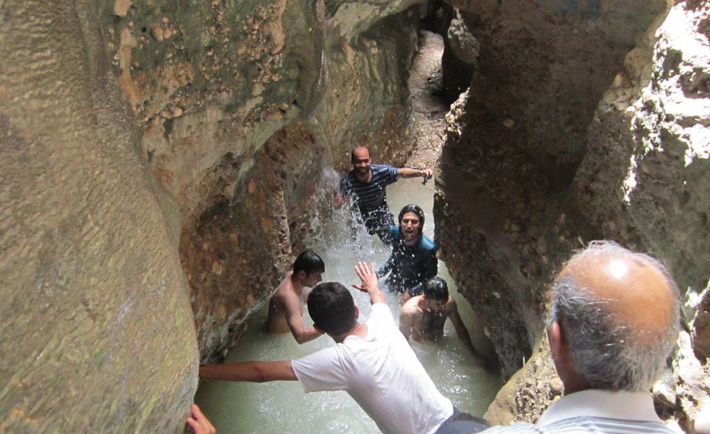
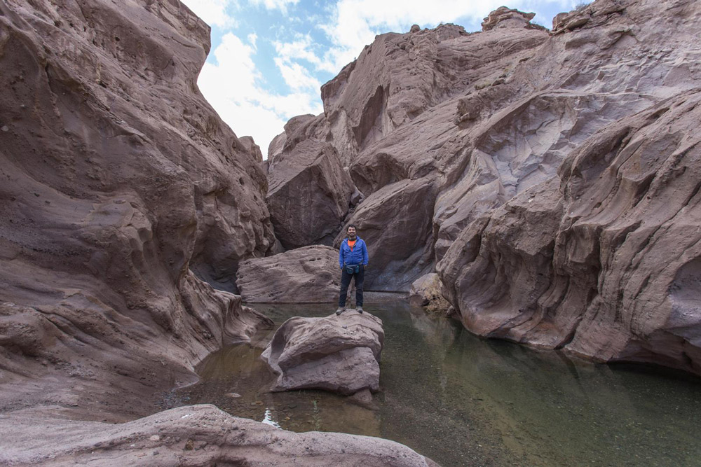
Qahan Valley is one of Iran’s beautiful valleys in Qom province and Khajelstan district, situated approximately 35 kilometers away from the Saveh-Salafchegan road. The depth of the notches within the Qahan Valley is about eight meters, and sunlight does not reach them throughout the year. Consequently, the valley’s climate is more relaxed than the surrounding desert lands. A river flows through this valley, with some parts reaching depths of 1.5 meters, making them suitable for swimming.
Throughout the Qahan Valley, various villages are situated, including Aghlak, Benaber, Jamzeqan, Qahan, Novis, Kasava, and Anjileh. The farther you go along the Qahan Valley route, the rockier the terrain becomes, eventually leading to high mountains. The villages at the end of the valley route possess the terraced structures typical of mountain villages.
Several qanats (traditional underground channels) are found around the Qahan Valley, which are the water sources for the villages in this area. One can spot medicinal and aromatic plants throughout the valley, with their scents wafting through it in spring. The width of the Qahan Gorge ranges between one and two meters, and its length is about two kilometers.
Visiting the valley and gorge of Qahan is possible throughout all seasons. However, the most picturesque views and the best climate are experienced during the spring. The summer season in this region is devoid of the intense desert heat. If you are keen on camping in nature, bring the necessary camping equipment when visiting the Qahan Gorge and Valley. The valley’s villages are also suitable for overnight stays and offer some amenities.
To access Qahan Valley in Qom, head along the Saveh road towards Salafchegan. The entrance route to the Qahan Gorge is near the Qahan village, and the secondary road is mountainous. When traveling this road during winter, ensure you are equipped with suitable winter travel gear.
Kol Khersan Valley
- Difficulty Level: Medium
- Approximate Length of the Route: 10 kilometers
- Estimated Trekking Time: A one-day trip (four hours on the way there)
- Best Time to Visit: Mid to late spring
- Geographical Location: N32°35’40” | E48°32’11”
- Address: North of Khuzestan province, northeast of Dezful city, Bisheh Bazan village
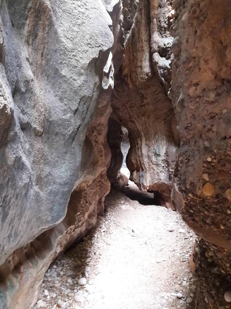
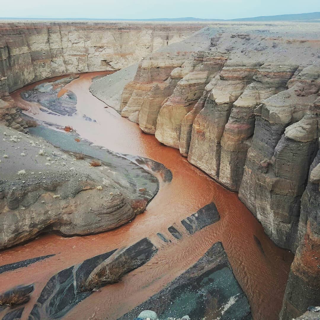
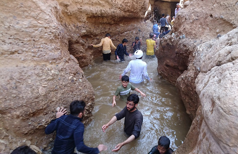
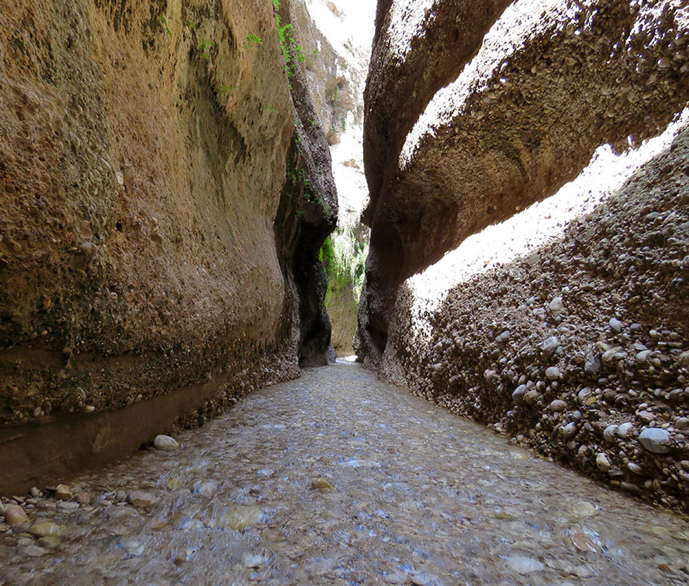
Kol Khersan is one of Khuzestan, Iran’s twisty and intertwined valleys. Locals of surrounding villages refer to it as the “Kol Khersoon Valley.” This valley is situated amidst towering and winding walls, where, in some parts, only one person can pass through the width of the path. “Kol” in the local language means “very narrow.” Due to the structure of Kol Khersan Valley’s walls and its eerie ambiance, it is also called the “Valley of Spirits.”
The depth of Kol Khersan Valley reaches over 200 meters in some parts. Its walls are sandy, silty, and sandstone, with flowing water between their grooves. Streams from the walls converge to form a river within the valley. The farther you trek into Kol Khersan, the higher its surrounding walls get, making the path more challenging. Throughout the route, you’ll witness diverse vegetation, including mountain almond trees, jujube, and palm trees. Several natural springs emerge from the walls and flow amidst the trees.
The valley stretches about 10 kilometers, ending at the Dez River. To traverse the final sections of the valley, you’d need to wade through water. As you trek Kol Khersan, various intersections and side paths lead to beautiful natural attractions. Navigating Kol Khersan might not be suitable for all tourists and requires some physical preparation. Noteworthy interests include the Dez Dam and Ashkaft Zardeh Valley.
Kol Khersan is a pristine region. If you plan to camp there, ensure you bring your camping gear. Before camping, check the weather forecast, and avoid setting up a camp if there’s a possibility of rain. The closest city to the valley is Dezful, and the villages “Paqleh,” “Bisheh Bazan,” and “Pamenar” are nearby. These villages offer various local lodging options, providing suitable choices for overnight stays.
The best time to visit Kol Khersan is spring’s last days. The temperature difference between Kol Khersan and Dezful is about 15 degrees Celsius, making a summer visit also feasible. An essential tip for traveling to Kol Khersan is to avoid trekking during rainy days, as flash floods can cause water levels between some walls to rise to 15 meters, posing a drowning risk.
To visit Kol Khersan Valley, head from Dezful City to Sheyoon Road. Continue on this road until you reach the 28th kilometer, leading you to Bisheh Bazan village. When visiting this valley, ensure you trek in groups and seek assistance from local guides familiar with the route.
Showtariku And Owdabeh Valley
- Difficulty Level: Medium
- Approximate Length of the Path: 4 kilometers
- Estimated Hiking Time: One-day program
- Best Time to Visit: From the late days of winter to mid-spring
- Geographical Location: N27°11’26” | E53°12’20”
- Address: West of Hormozgan province, Parsian county, Chek Chek village
Showtariku and Owdabeh valleys are natural attractions of Hormozgan in the Parisian region. They are located a short distance from each other near the village of Chek Chek Parsian. The path to Owdabeh Valley starts from the middle of the Showtariku Valley route. Showtariku is nestled among rocky mountains with deep valleys and steep ridges. The abundant twists and turns in the rocks of this valley have emerged over many years due to erosion.
Along the path of the Showtariku Valley, a seasonal river dries up during the hot seasons and in years with low precipitation. You won’t need a high physical preparedness to explore these valleys. With relative physical readiness, you can traverse the length of this valley and enjoy canyoning in the Showtariku and Owdabeh narrows.
Showtariku and Owdabeh valleys are close, with their access path diverging from the middle of the Showtariku valley route. Multiple side routes are present along the Showtariku Valley; you’ll stray from the main course if you venture into them. For exploring Showtariku Valley and entering Owdabeh narrows, you’ll need guidance from local guides. There are more springs and waterfalls, both small and large, in the Owdabeh limits compared to Showtariku. The Owdabeh route is also less challenging and shorter.
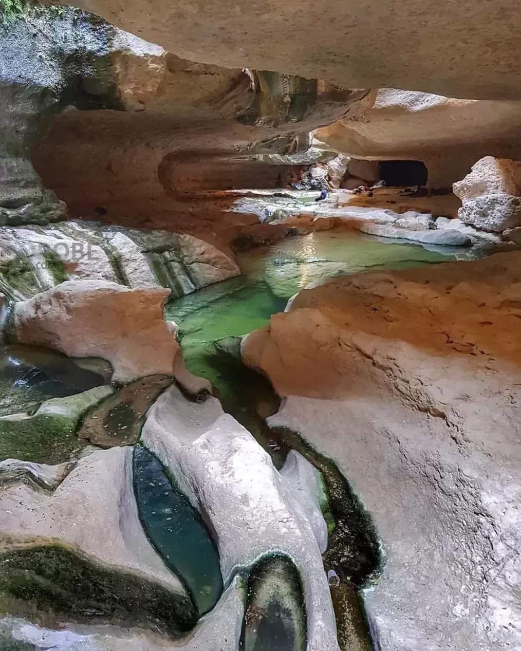
As you proceed in the Showtariku narrows, you’ll come across rocks with more twists and turns, some of which are roofed. Sunlight doesn’t reach these parts of the Showtariku valley, which is why it is named. The valley walls are slippery and smooth; hence, caution is needed. The ponds between these rocks are green and blue, filled with cool water. There are small and large caves among these ponds, which attract tourists for photography.
The best time to visit the Showtariku and Owdabeh valleys is from the late days of winter to mid-spring. During this time of year, this region experiences its least khamsin (hot, dry, dusty wind), and the climate inside the narrows is moderate. Remember to check the weather forecast and rainfall when visiting the Showtariku and Owdabeh valleys. If there’s a possibility of rain, do not enter the valley.
Showtariku and Owdabeh valleys are pristine, and their locations aren’t very suitable for overnight stays. The initial parts of these valleys are more appropriate for camping in nature. The local guesthouses in the Parsian villages are also good options for overnight stays in this region. To visit the Showtariku and Owdabeh valleys, take the road from Bandar Lengeh to Parsian west of Hormozgan. Thirty kilometers before reaching Parsian county, turn onto the side road leading to Chek Chek village. Directional signs will guide you to the Showtariku Valley.
Vizhdarvan Valley
- Difficulty Level: Difficult
- Approximate Length of the Route: 6 kilometers
- Approximate Time for Trekking: One-day plan
- Best Time to Visit: Summer season
- Geographical Location: N33.2743 | E46.2133
- Address: West of Ilam province, Malekshahi County, Gachi District, Mehr Village
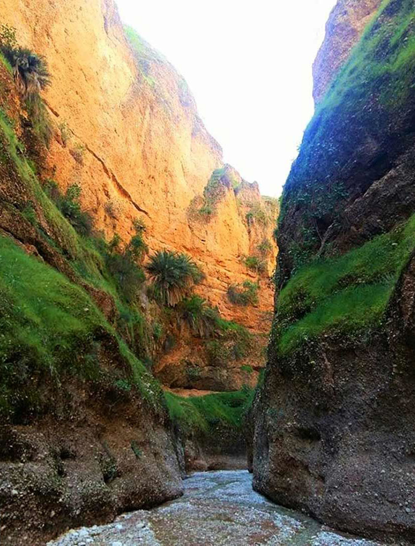
Vizhdarvan Valley, one of Iran’s beautiful valleys, is located in Ilam province and is characterized by tall, winding walls that envelop its entirety. The valley is near the “Cham Gerdalan” dam and the village of Mehr. The rocks and cliffs of Vizhdarvan Valley are made of limestone. Over the years, due to erosion by water and soil, they have evolved into their current form during various geological periods. Locals from surrounding villages and areas recognize this valley as “Vijh Doron.” In the Kurdish language, “Vijh” translates to “deep,” and “Doron” means “valley.”
Throughout the Vizhdarvan Valley, a variety of flora and fauna can be observed. Due to the presence of the Cham Gerdalan dam, the water flow in the valley has diminished compared to previous years. Vizhdarvan Valley, like the Qazvin Valley fissures, remained untouched compared to other valleys in Iran and has been an unknown route among nature enthusiasts for a long time. One of its most striking features includes tall, winding walls with narrow widths inside the valley. The Vizhdarvan Valley is over 800 meters above sea level, with its highest cliffs reaching over 200 meters.
To traverse the Vizhdarvan Valley, one must have a certain level of physical readiness. Visiting this valley without the assistance of local guides can be challenging. If planning to swim in the ponds of this valley, caution is advised when assessing their depth. Vizhdarvan Valley is entirely pristine and lacks amenities. For an overnight stay in the wilderness, one must bring complete camping gear or consider staying overnight in neighboring villages and towns and visiting the valley during the day.
The best time to visit Vizhdarvan Valley is in the summer season. Do not enter the valley during rainy days or when the dam gates are open, as there’s a high likelihood of flash floods in the valley during these times. To enter this valley, choose one of the routes via the “Marbreh” road from Ilam or the “Galan” village near Allahabad village and Mehran town. The first route from the west of the Cham Gerdalan dam leads to the entrance of the Vizhdarvan Valley, and for the second route, you’ll need to trek a dirt path for nearly two hours to reach the ponds of Vizhdarvan Valley.
Shamkhal Valley
- Difficulty Level: Difficult
- Approximate Path Length: 18 kilometers
- Approximate Trekking Duration: 2-day plan
- Best Time to Visit: From mid-spring to the last days of summer
- Geographical Location: N37°34’53” | E58°28’36”
- Address: North of Khorasan Razavi Province, Northwest of Quchan county, 3 kilometers away from Bajgiran city, Shamkhal road
Shamkhal Valley is among the most beautiful valleys in the northeastern part of Iran, near the border city of Bajgiran. Numerous rivers and springs flow along the valley, modulating the region’s climate. Among the principal rivers of the Shamkhal Valley are Sharak, Darbadam, and Shamkhal rivers.
The Shamkhal Valley has tall, narrow walls, with the highest points reaching 200 meters. This valley is about 18 kilometers long, and to trek it, one needs to cover approximately 40 kilometers in a round trip. After traveling about 10 kilometers in Shamkhal Valley, you will arrive at the “Water Bath,” a favorite summer spot for many tourists.
Massive rocky walls cover the entirety of Shamkhal Valley. Passing through them is not simple for every tourist. Although this valley is very scenic and has pleasant weather, without high physical preparation and prior canyoning experience, do not choose Shamkhal Valley for your first canyon trekking. The valley boasts a diverse vegetation; walnut trees are scattered throughout Shamkhal Valley. Other plant species in this area include plane trees, poplars, blackberries, willows, pistachios, wild rose bushes, and many wild shrubs.
The best time to visit Shamkhal Valley is during the summer. Considering the weather and previous rainfall data, you can also plan your visit from mid-spring. The best strategy to explore Shamkhal Valley is to plan for two days, camping in the valley’s natural surroundings. Passing through the long path of this valley in one day isn’t easy for many tourists. Halfway through the valley, the Kabootarkhaneh area, with its abundant springs, provides an ideal environment for resting.
To visit Shamkhal Valley, first get to Quchan. This valley is roughly 80 kilometers north of the city and 5 kilometers east of Bajgiran. You don’t need to pass through Bajgiran city to reach Shamkhal Valley from Quchan; however, if you wish, you can stay in accommodations in that city.
Laask Valley to Siahrud Lake
- Difficulty Level: Difficult
- Approximate Length: Undetermined
- Approximate Hiking Time: Two-day plan
- Best Time to Visit: From late spring to mid-summer
- Geographic Location: N35.5306 | E52.3340
- Address: Northeast of Tehran Province, Firuzkuh County, Lazur Village
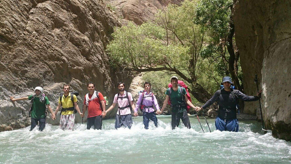
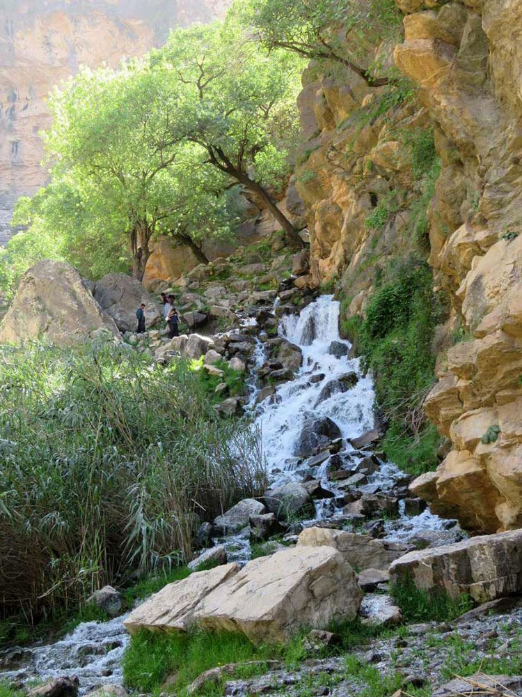
The Laask Valley, which leads to Siahrud Lake, is along the ascent path to the Mishineh Marg peak in northern Tehran. The trail starts from the village of Lazur. Navigating through the valley, you’ll pass the Ab-e-Tangeh (water strait) and the Mojaz Cheshmeh plain before reaching the Siahrud Dam Lake. The elevation of the Laask Valley is approximately 2,500 meters above sea level. Throughout the year, both canyon and mountain climbers frequent the slopes of the Mishineh Marg mountain to traverse this valley.
To start your journey in the Laask Strait, you’ll meander through the green orchards and fields from the village of Lazur, heading toward Imamzadeh Khoshnam. The entrance to this strait can also be accessed by vehicle. As you trek along, you’ll find a river running through the Laask Strait with chillingly cold water. Navigating this path involves passing through the water at various points. A highlight of this route is the Laask Waterfall, located within the strait.
After the Laask Strait and waterfall, you’ll encounter the Mojaz Cheshmeh plain, a perfect spot for camping and staying overnight on your journey to the Siahrud Dam Lake. The lake is a mere 30-minute hike from this point. However, traversing the Laask Strait can be challenging, especially for novices. It requires good physical preparation.
The ideal time to explore the Laask Strait ranges from the latter part of spring to mid-summer. During this period, the vistas of the Laask Strait and the Mojaz Cheshmeh plain are at their most lush and picturesque—conversely, autumn and winter cloak the region in snow and freezing temperatures, which linger until mid-spring.
Buchir Valley
- Difficulty Level: Difficult
- Approximate Length: One kilometer
- Approximate Hiking Time: One-day plan
- Best Time to Visit: From late spring to late summer
- Geographic Location: N27.0622 | E53.3509
- Address: West of Hormozgan Province, Parsian County, Buchir Village
Buchir Valley is among the natural attractions of Parsian County in the west of Hormozgan Province. This valley is located near Buchir’s village, also known as Buchar Strait. The depth of this strait reaches about 50 meters, and although the surrounding areas have a hot and dry climate, the inside of the channel is remarkably calm.
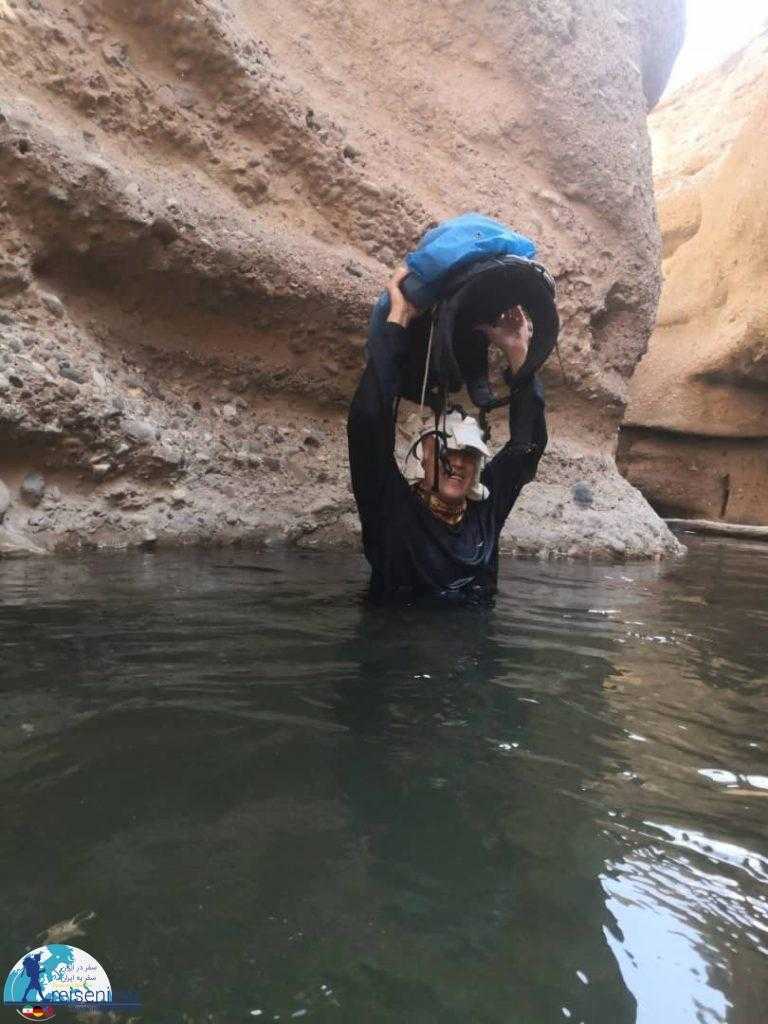
The Buchir Strait is the gap between two mountains, with a deep river flowing through it. Only parts of the path inside the Buchir Strait pass through the dry valley, and the remainder must be traversed in the water. By crossing this strait, you will arrive at the Buchir spring and waterfall. To cross this river, you don’t need to swim throughout the route; you can traverse the strait using inflatable boats.
To visit and traverse the Buchir Strait, you will need appropriate equipment, such as a life jacket. Navigating this strait, especially its water route, is unsuitable for individuals with low physical readiness and those without swimming skills. Given the water route of the Buchir Strait, summer is the best time to escape the potential flooding of rivers. Before entering the strait, be sure to inform the council of the Buchir village about your nature-tourism plans.
To visit the Buchir Strait, head to Parsian County and drive along the scenic road from Bandar Moqam to Parsian. This strait is located at the midpoint of this road, about five kilometers from the Buchir village. The secondary road to the Buchir Strait is a dirt road west of this village.
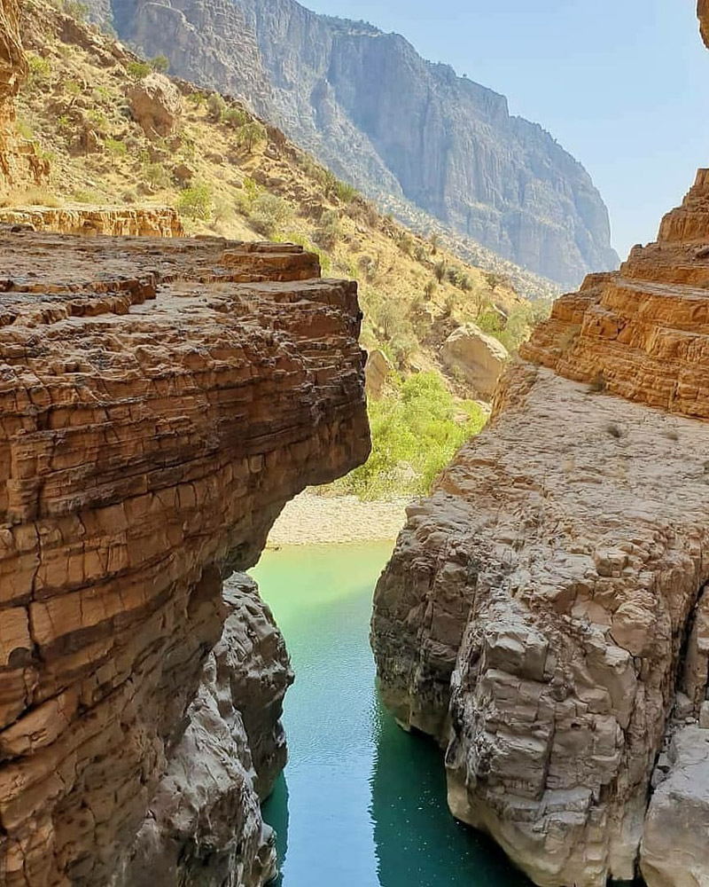
Raghz Valley
- Difficulty Level: Very Difficult
- Approximate Length: Indeterminate due to numerous waterfalls and pools
- Approximate Hike Time: Two-day plan
- Best Time to Visit: From mid-spring to the last days of summer
- Geographical Coordinates: E54.1805 | N28.4945
- Address: East of Fars Province, Darab County, Fasaroud District, Raghz Village
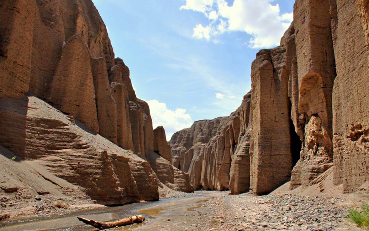
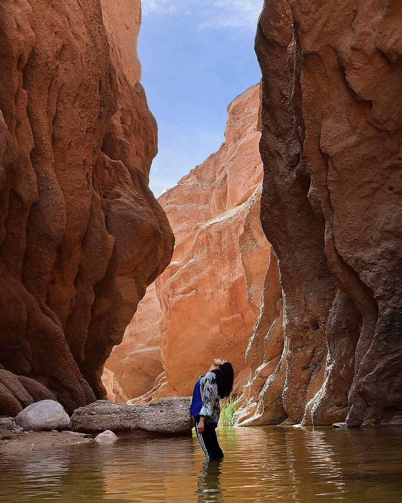
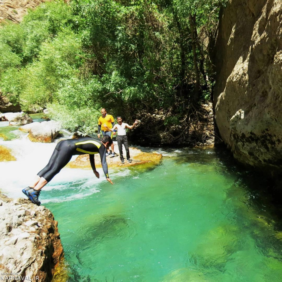
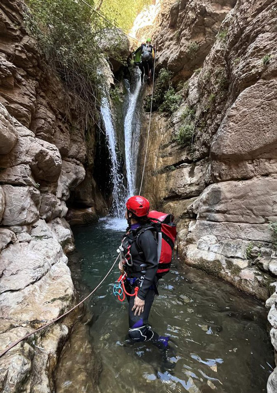
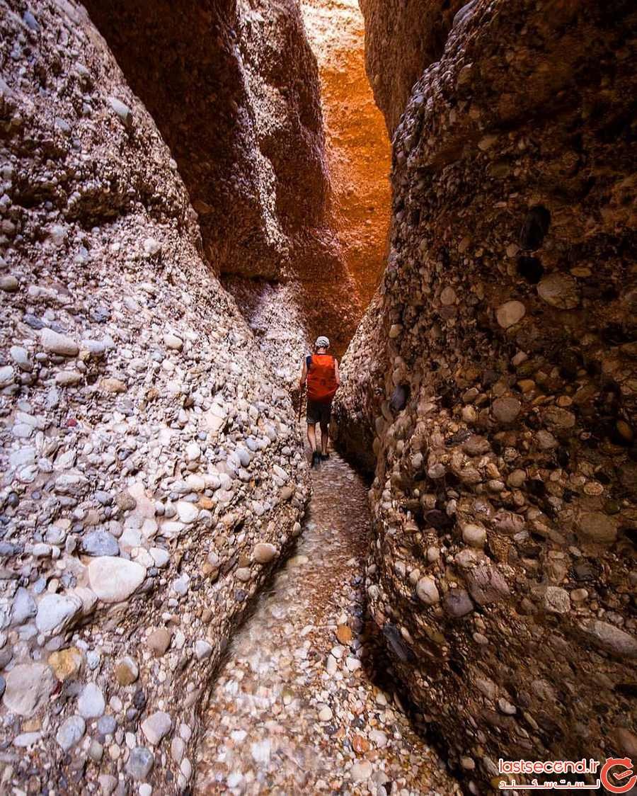
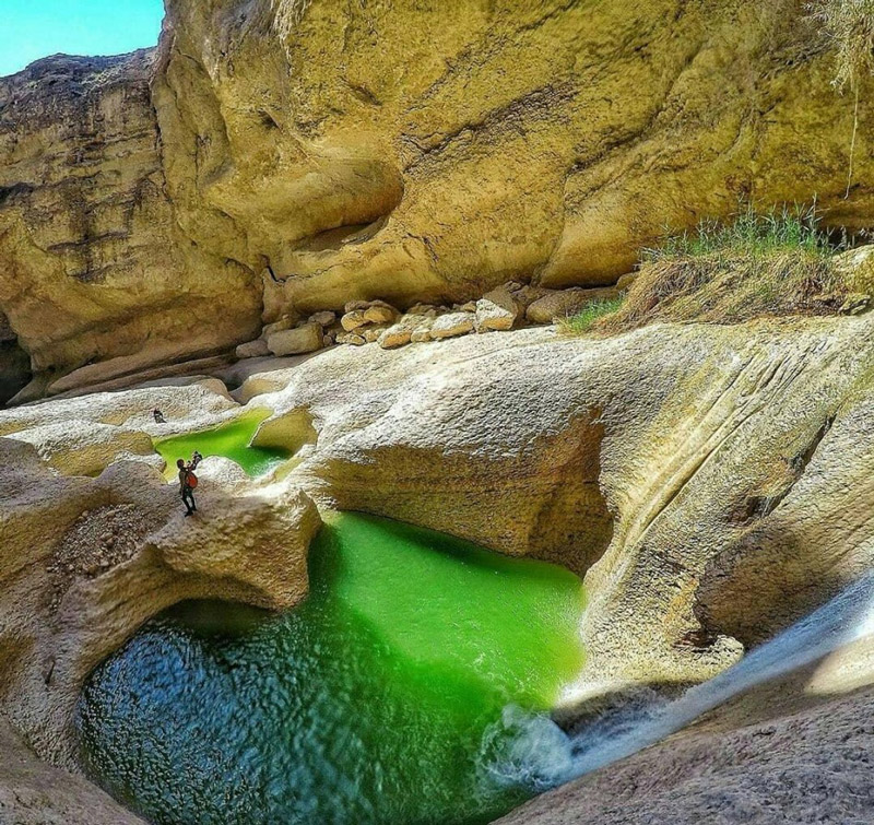
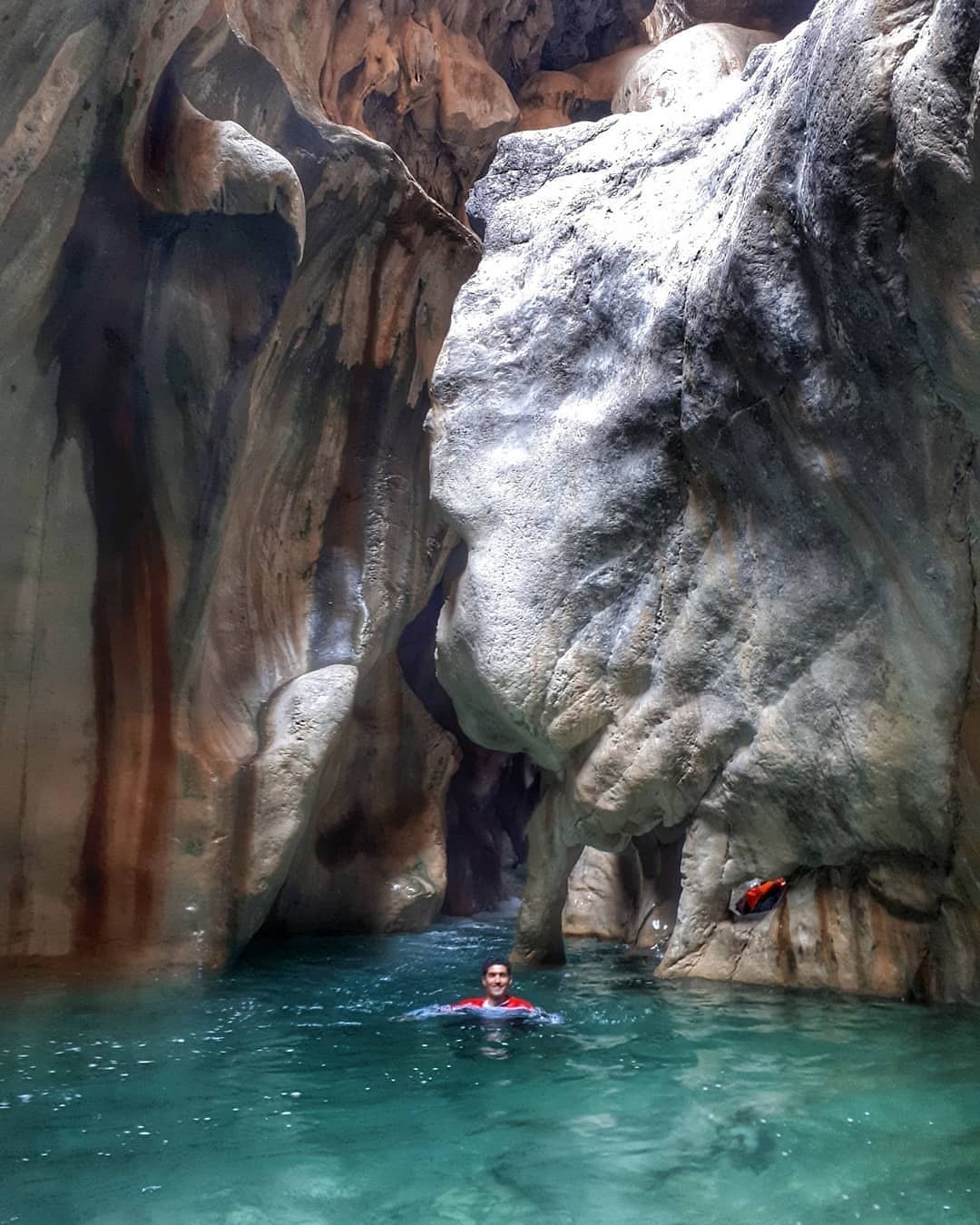
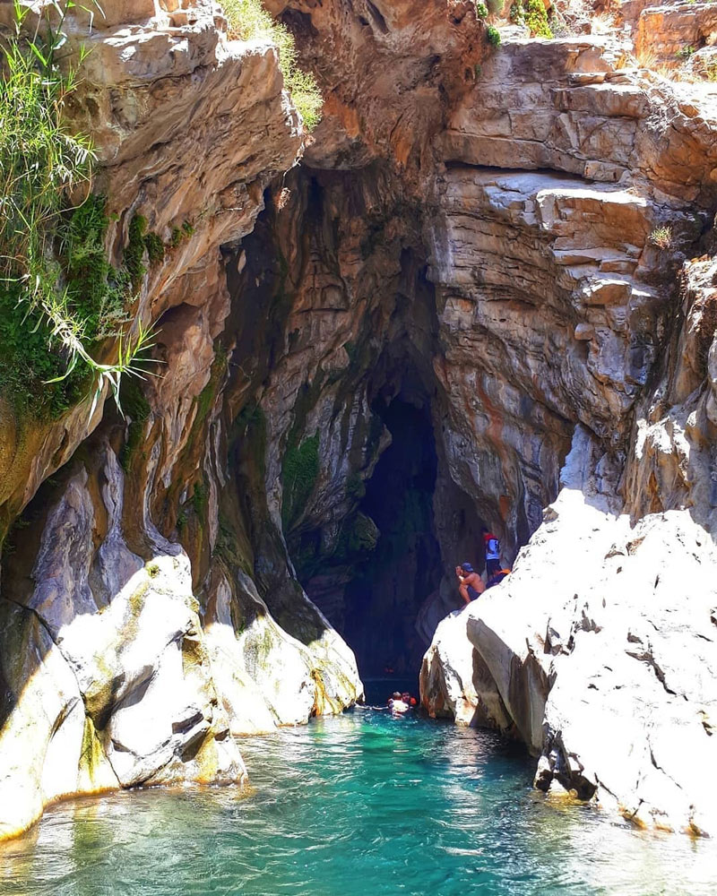
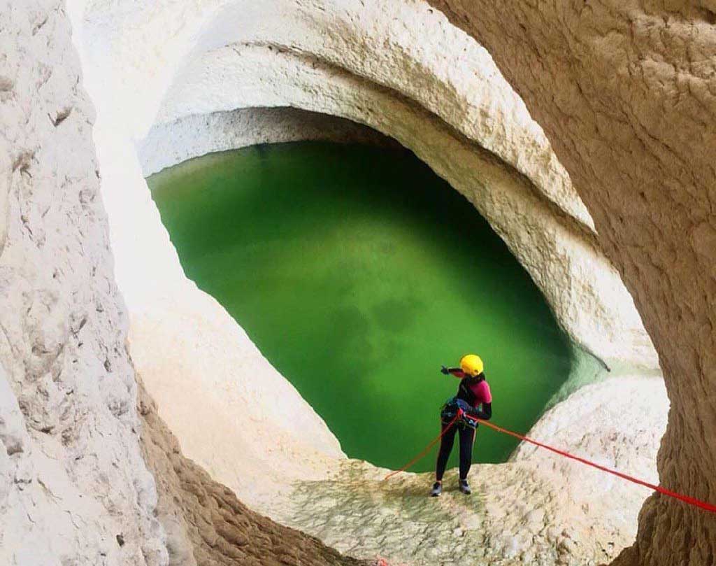
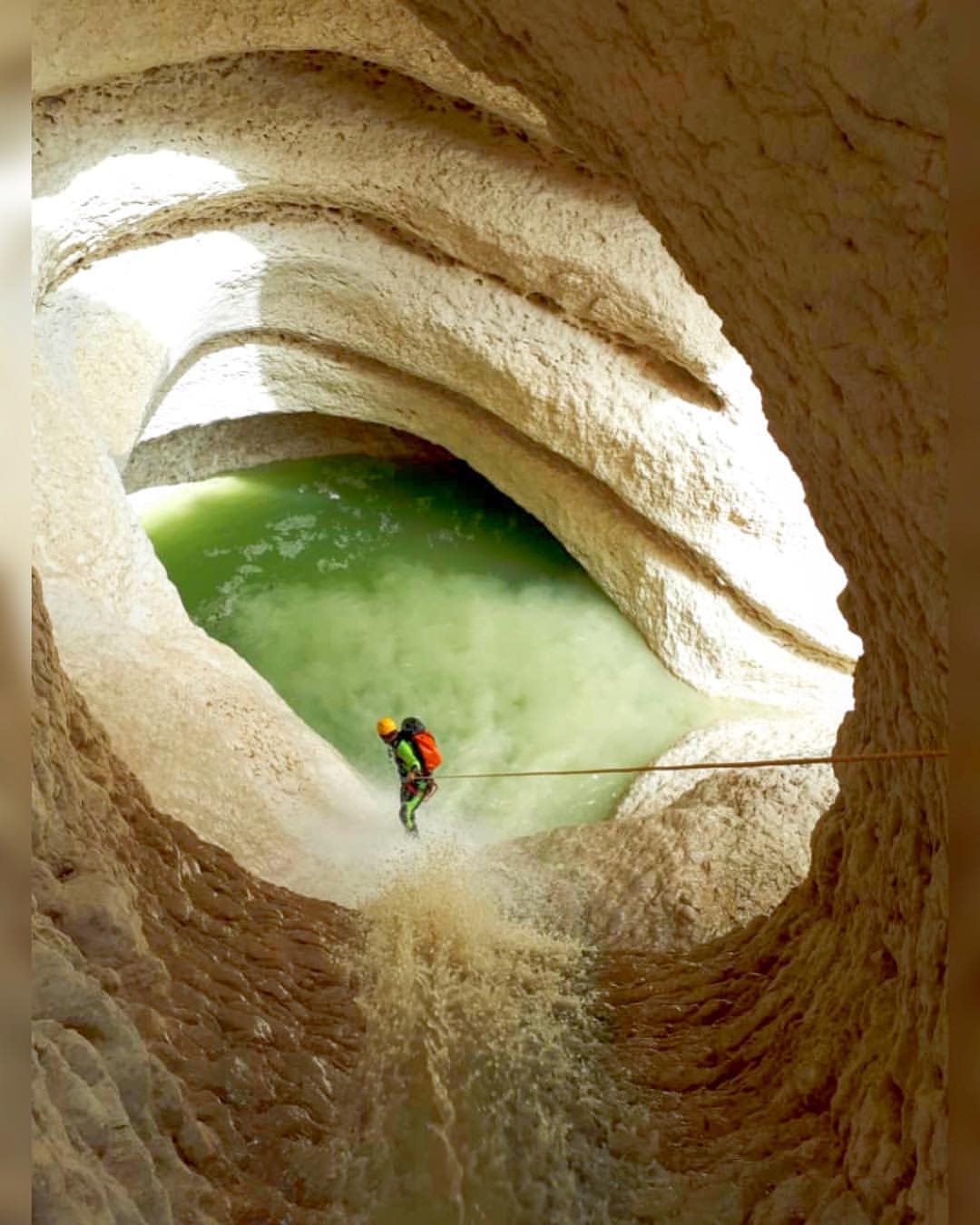
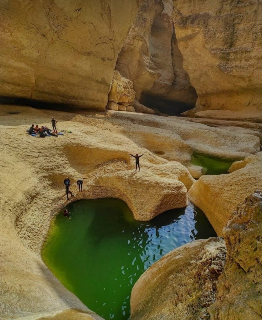
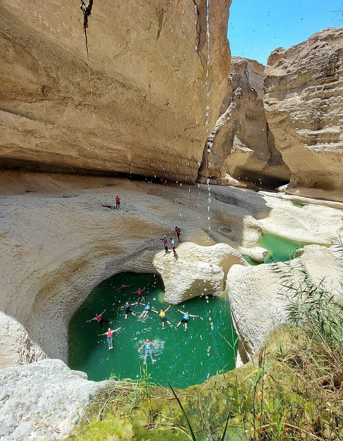
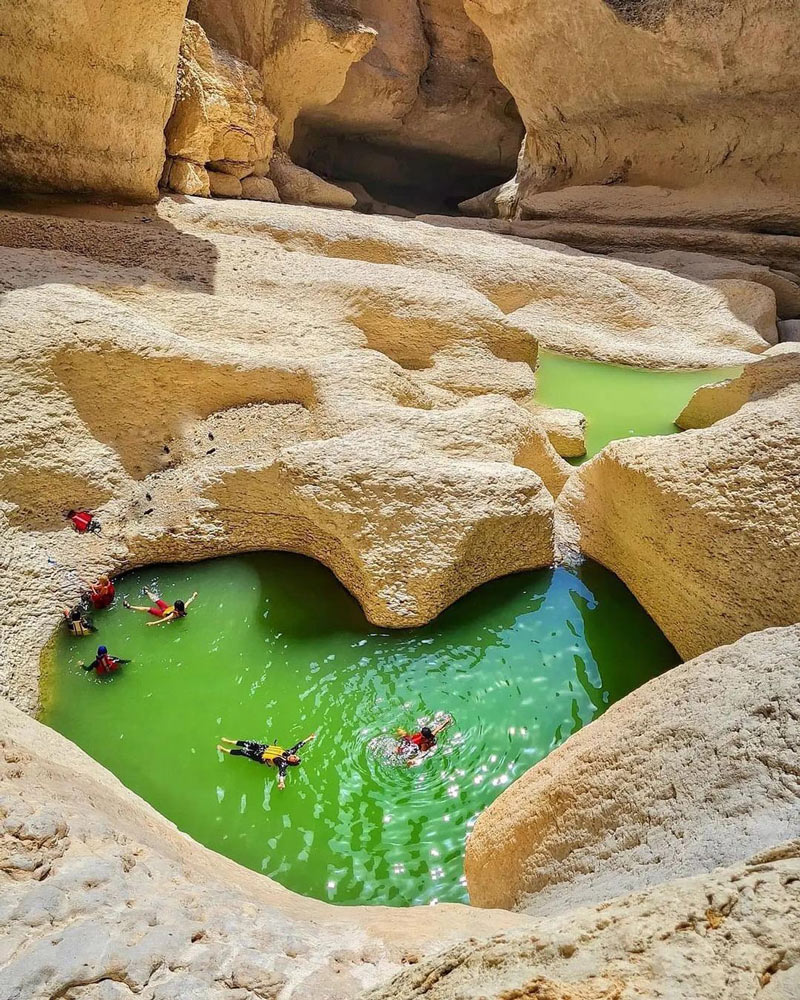
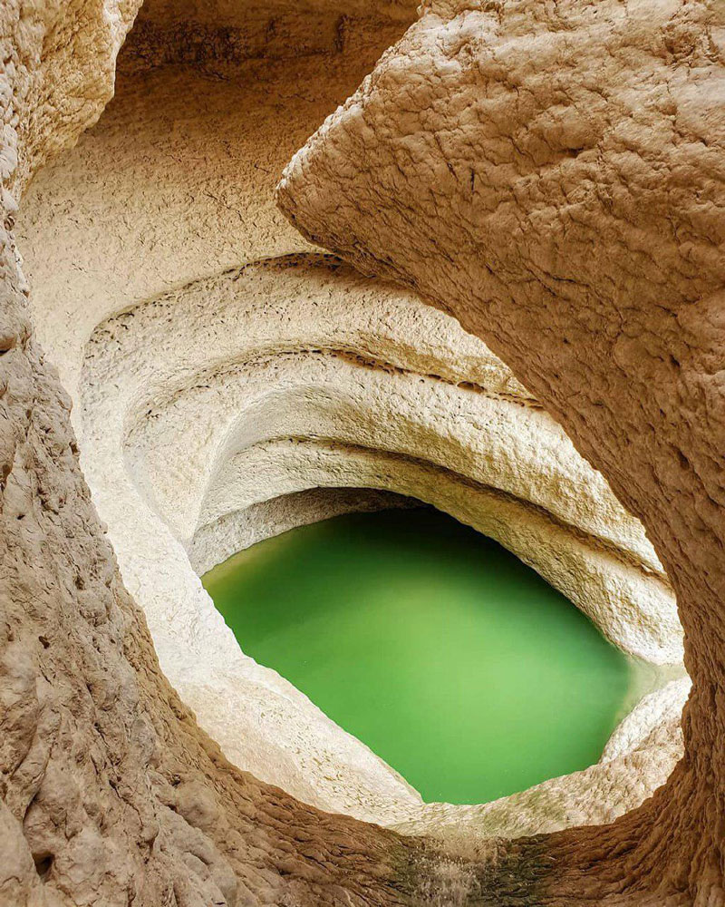
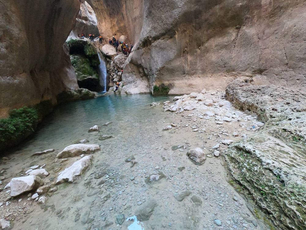
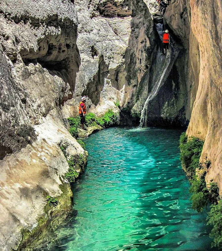
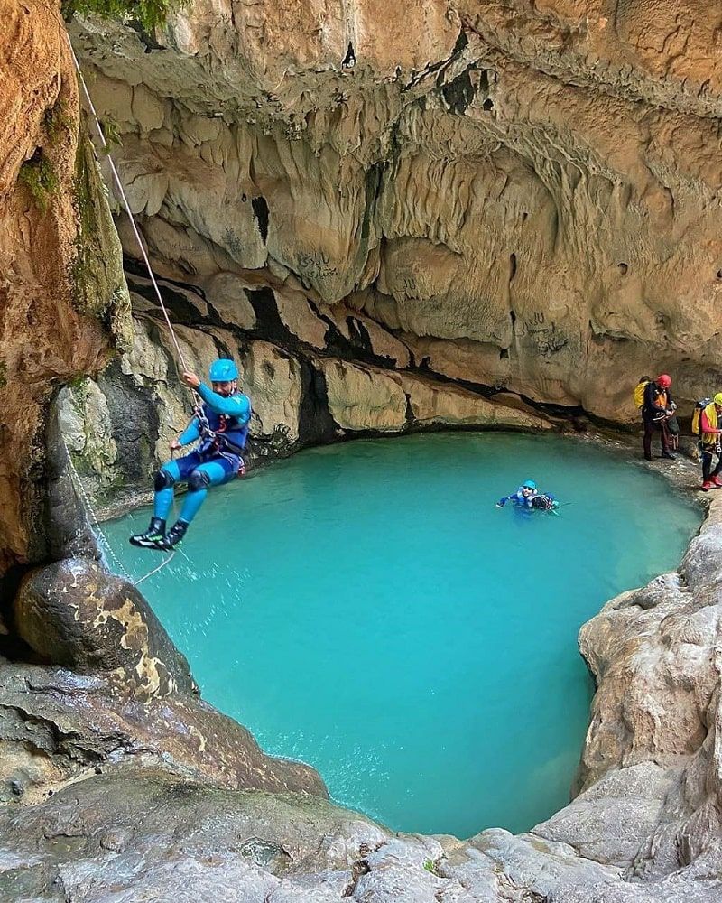
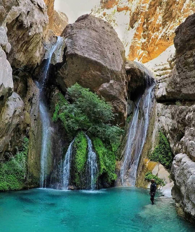
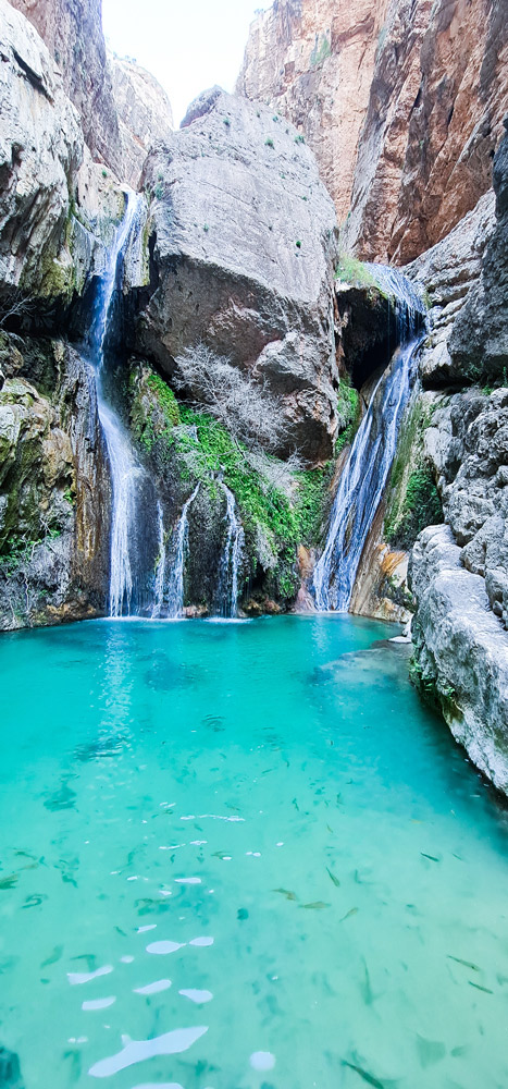
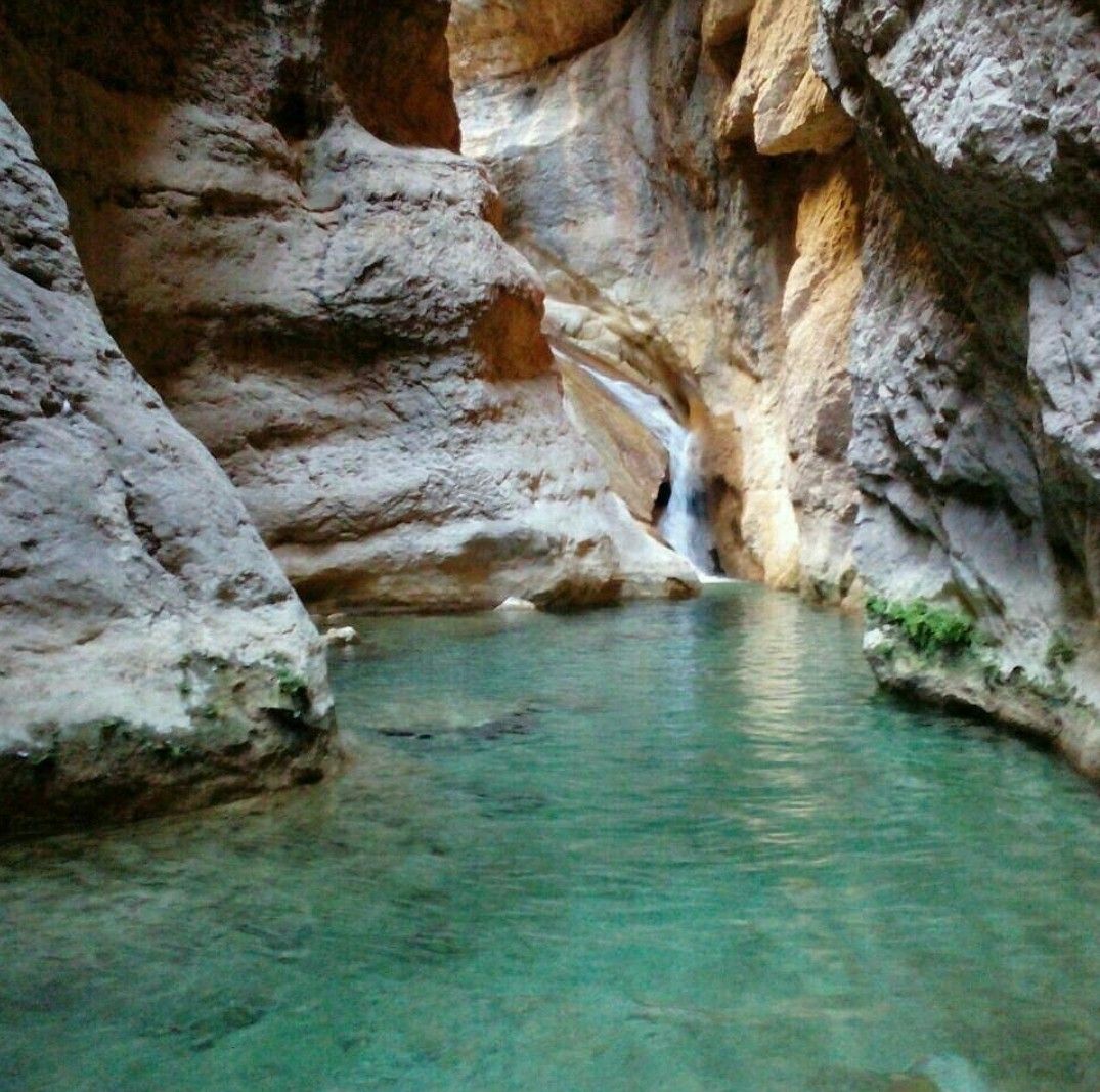
Raghz Valley is one of Iran’s most beautiful and challenging canyoning routes, attracting professional canyers and mountaineers. The canyon is often called the “Bride of Iran’s Canyons” due to the stunning natural attractions along its path. This canyon is located near the Raghz village in Darab County of Fars.
One of the most notable features of the Raghz Valley route is the presence of 64 waterfalls throughout. Crossing 12 of these waterfalls is not feasible without professional equipment. Visiting this canyon requires good physical preparedness and extensive canyoning experience. A significant part of the Raghz Canyon path goes through water; you must swim across these sections.
Another distinguishing feature of the Raghz canyon is the varying heights of its waterfalls. If you’re afraid of jumping from heights, reconsider exploring this canyon. Besides very high waterfalls like the Veda Waterfall, which is 46 meters high and requires equipment to cross, you’ll need to jump into pools to pass other waterfalls. In these pools, you can find trout swimming around.
The most crucial point when exploring Raghz Canyon is to have a guide familiar with the route. Always consult the principles before jumping into any pool, as jumping into shallow pools can cause severe injuries. Suitable camping spots along the Raghz Canyon are limited, but with the help of a guide, you can find the best place to camp. The Raghz Canyon is a bird haven, and numerous bird nests can be spotted throughout. After crossing the canyon’s waterfalls, you will reach a dry area and walk a considerable distance. The walls of this canyon have an interesting architecture, with some sections being concave.
The best time to visit Raghz Canyon is from mid-spring to the end of summer. Visiting during rainy seasons is not advisable. To enter Raghz Canyon, you must first get to Darab County. There are two routes to enter Raghz Canyon; in one, you’ll have to walk for about five hours, and in the other, you can use an off-road vehicle for part of the route and walk for about three hours. The first route takes you from the east of Raghz Canyon and the second from the west. You will need the assistance of local guides for both ways.
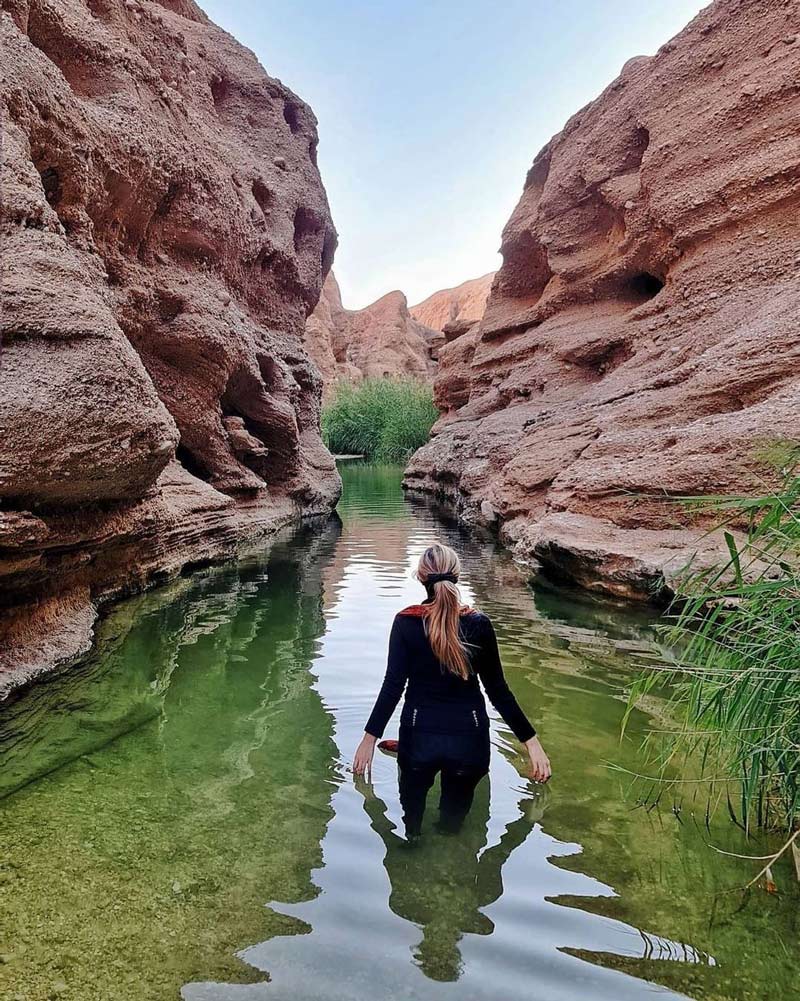
Eshkaaf Valley
- Difficulty Level: Very Difficult
- Approximate Length of the Trail: 13 kilometers
- Estimated Duration: One-day trip
- Best Time to Visit: Summer season
- Geographical Location: N36°37’17” | E50°10’18”
- Address: Northeastern Qazvin province, Almost Gharbi, Razmian district, Rouh Abad village
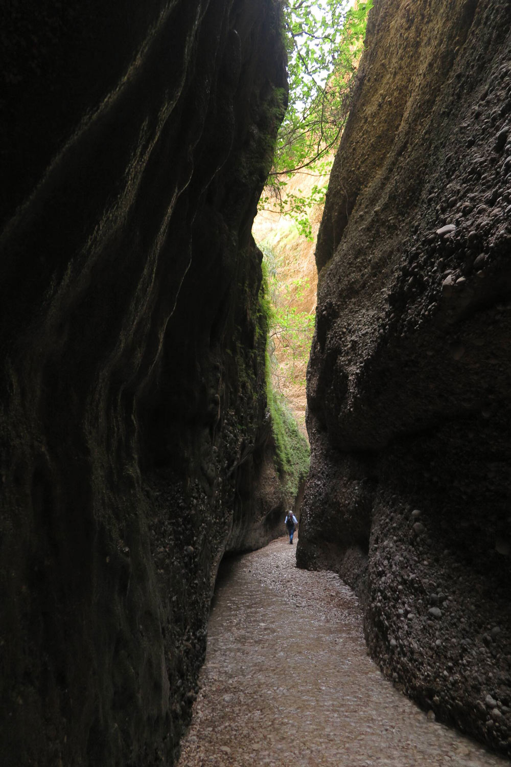
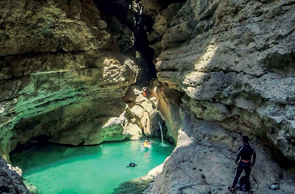
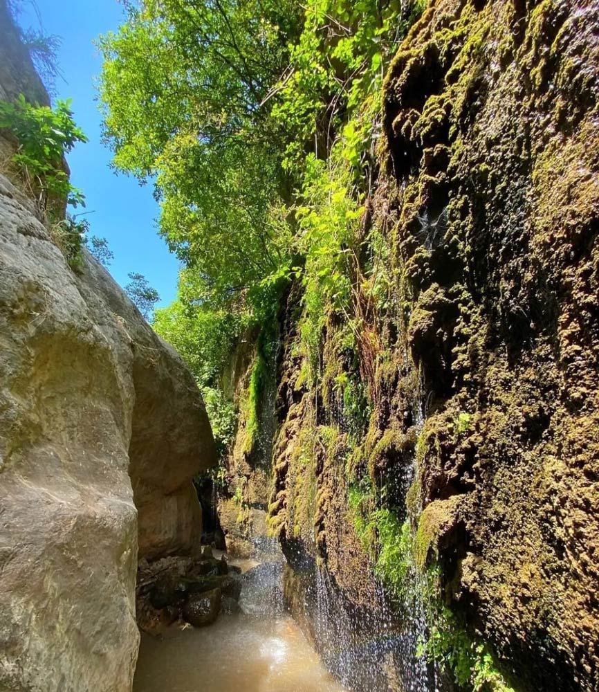
Eshkaaf Valley is in the Almout Gharbi area of Qazvin province and is known as the “Talatar” valley. This valley boasts 32 waterfalls, two reaching up to 20 meters. The Eshkaaf or Talatar valley was unknown to tourists for a long time until locals from the surrounding areas discovered it. The nearest village to this valley is named “Rouh Abad.”
Eshkaaf Valley is suitable for professional canyoners. This valley is counted among the most challenging canyon trails in Iran. If you don’t have the appropriate physical preparedness and high experience in canyoning, it’s best not to enter this valley. The pools beneath the waterfalls in the Eshkaaf Valley have depths ranging from one to three meters.
To navigate the waterfalls of Eshkaaf Valley, you must be equipped with proper canyoning gear. The shortest waterfall in this valley is approximately two meters high. Apart from the diverse waterfalls, 12 springs have been identified on the Talatar Gorge route. This valley is situated about 1,200 meters above sea level.
The best time to trek through the Eshkaaf Valley is during the summer season. It is also possible to traverse the valley during the spring and autumn; however, it is unsafe to do so during the cold winter days and rainy periods. There are limited accommodation spots on the Qazvin Talatar Valley route. Given the valley’s pristine nature, choosing nearby areas for camping is recommended. The surrounding villages also offer local tourism accommodations and rental homes. The Talatar or Eshkaaf Valley in Qazvin is possible through the Rouh Abad village in the “Razmian” Almout region.
Important Tips for Canyoning
Observing specific guidelines will ensure your safety and help you tackle potential challenges when navigating canyons. If you have little experience in canyoning, please take these points into account before you embark on your journey:
- Before traversing the area’s topography and the canyon’s specific characteristics.
- Remember, most canyons don’t offer adequate cell phone signals throughout their paths.
- During the spring season, the rivers inside the canyons tend to be at their fullest.
- Check the weather conditions before canyoning in the spring, fall, and winter. On rainy days, the canyons have a high risk of flash floods.
- For camping in the canyons, choose areas near the entrances and exits, and avoid camping in inaccessible and unfamiliar locations.
- When traversing water canyons, always carry a life vest. If you’re not a skilled swimmer, refrain from navigating these canyons.
- In general, you’ll need a relative physical readiness for canyoning.
- Always navigate canyons in groups.
- Inform local village councils and local authorities about your ascent into challenging canyons.
- When canyoning, it’s essential to seek assistance from local guides familiar with the route.
- In water-filled pathways, avoid diving headfirst into pools; instead, jump feet-first whenever possible.
- Ensure you wear professional and specialized canyoning shoes.
- Respect the natural environment and wildlife in the canyons, and do not harm them.
In this article, we introduced some of the best canyons in Iran for canyoning and reviewed the necessary guidelines for the activity. You’re also welcome to share your canyoning experiences in various parts of Iran with us and other users.
Our top pick for adventure tours to Iran's natural spots

Exploring Iran
Special Tours to Iran for English Speakers
in your
Native language