Best Cycling Routes in Iran: A Journey through Unmatched Landscapes
What you will read in this article:
Where can I go mountain biking in Iran
Explore the Hir to Khatbeh Sara route in Ardabil and Gilan for an unforgettable mountain biking experience, or the Sang-Deh to Oban Waterfalls Trail in Mazandaran for a challenging ride through dense forests.
What are the best seasons for cycling in Iran?
Spring and autumn are ideal across most of Iran, offering pleasant weather for cycling adventures. Check specific trail recommendations for the best experience.
Can I bike in the deserts of Iran?
Yes, the Miyandasht to Touran route offers a unique desert biking experience, taking you through the heart of Iran’s stunning desert landscapes.
Are there any cycling trails near Tehran?
The route from Tehran to Dasht-e Lar offers scenic mountainous terrain close to Tehran, perfect for a day trip or weekend adventure.
Where to cycle on Kish Island?
Kish Island’s dedicated bike path allows you to enjoy coastal views and explore urban areas, perfect for an easy ride.
Can beginners bike in Iran's natural trails?
Yes, trails like the Tafresh to Saveh route provide an easier ride through beautiful villages and orchards, suitable for beginners.
How to prepare for cycling in Iran's diverse terrains?
Ensure you have the right bike type, possess technical biking skills, and are physically ready. Familiarizing yourself with the chosen route is also crucial.
Are there guided cycling tours in Iran?
Guided tours are available, especially for challenging or less-known routes, offering insights and safety on your journey.
Where to find accommodations near bike trails in Iran?
Many routes are close to villages or cities with lodging options, making it convenient to plan overnight stays.
What are the unique cycling experiences in Iran?
From urban cycling on Kish Island to crossing desert plains and tackling mountainous terrains, Iran offers a variety of unique cycling experiences.
What You Need to Know About Cycling in Iran?
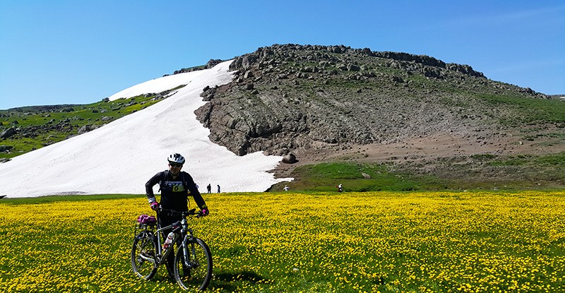
Hir to Khatbeh Sara Route; Provinces of Ardabil and Gilan
- Starting Point: 30 kilometers southeast of Ardabil, Hir region, Darband Hir
- Route Characteristics: Passing through valleys and plains to the coast
- Type of Route: Mountainous, dirt road, coast
- Route Length: About 57 kilometers
- Route Difficulty: Medium (3 out of 6)
- Starting Elevation: 1,756 meters above sea level
- Maximum Elevation: 2,531 meters above sea level
- Best Season: Spring
- Nearest Village to Starting Point: Kohsareh
- Nearest City to Starting Point: Hir
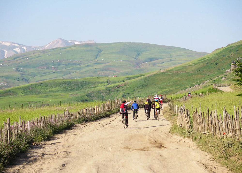
Hir is a city in the Hir region of Ardabil province. Its pleasant climate and beautiful nature are among the reasons for its popularity. Darband Hir Valley, located one kilometer from Hir city, is a unique natural area known as Iran’s tourism paradise. Darband Hir covers an area of 234 square kilometers. Fruit trees, diverse vegetation, rivers, and numerous springs are among this valley’s natural attractions. Hir’s suspension bridge is another attraction in Darband Hir, spanning the Hirchai River. Walking across this glass bridge is an exciting and fun-filled activity. The Darband Hir area in Ardabil province is a great starting point for a memorable bike tour. Professional cyclists often cycle from Hir to the coast of Khatbeh Sara in Gilan province, either on tours or with groups of friends. To reach the Hir and Darband Hir areas by car, take the “Ardabil – Khalkhal – Sarcham” route and then drive on Giwi road to exit onto “45-meter Boulevard” (before Kargan). This boulevard leads to Hir city. The road from Hir to Kohsareh (northeast of the town) is the access route to Darband Hir.
Start cycling from the Darband Hir Valley until you reach the Kiasala area. At the Kiasala intersection, take the route to Ahare Bahar (on the left). At the next meeting (Kiasala, Demdeme, Ahare Bahar), follow the Ahare Bahar route. Pass through “Qareh Bolagh” and “At Hamar” until you reach “Bandy Bolagh.” There’s a straightforward blue spring in this area, suitable for resting. Continue and pass through “Komorlo” until you get to the river. From here, the route is a defined dirt road. From this point onward, you will descend, and the path is downhill until you reach the coast. Pass through “Tamsha Lahe,” “Binoon Protected Area,” and “Rivo Waterfall” in Gilan province until you arrive at the Khatbeh Sara village in Talesh county and its beautiful coast.
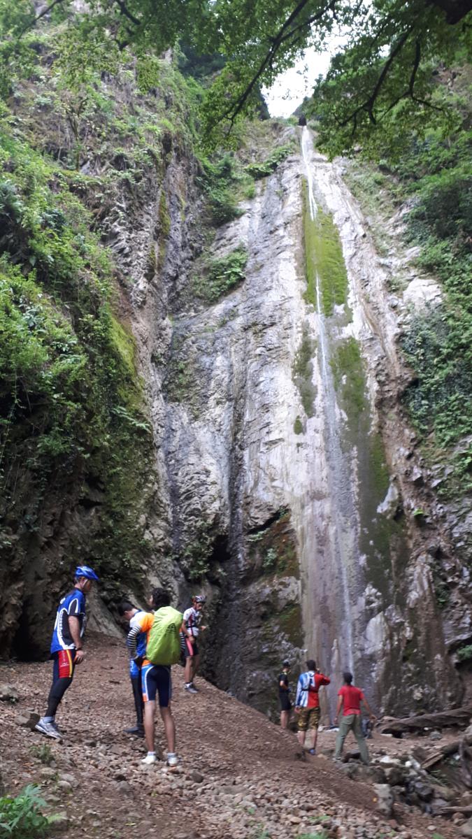
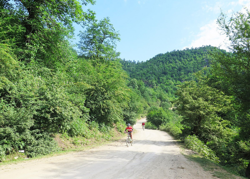
Sang-Deh to Oban Waterfalls Trail; Mazandaran Province
- Starting Address: Sari County, Dodangeh District, Bonaft Rural District
- Route Features: The route is surrounded by dense Caspian Hyrcanian mixed forests on both sides.
- Type of Route: Mountainous, winding dirt road with uphill climbs.
- Route Length: Approximately 70 kilometers.
- Route Difficulty: Challenging (5 out of 6)
- Starting Altitude: 1,200 meters above sea level.
- Maximum Altitude on the Route: 1,750 meters above sea level.
- Best Seasons: Spring, Summer, and Autumn.
- Nearest Village to the Starting Point: Darzikola.
- The nearest City to the Starting Point is Pol Sefid.
Sang-Deh village is near the Hyrcanian forests at the foothills of “Shrovin Mountain” and “Shahriar Mountain.” The town used to be known as “Seyed Deh.” The scenic and forested trail from Sang-Deh to “Oban Waterfall” is recognized as a prime destination for cycling. This nature trip is designed for a day’s journey. To reach Sang-Deh village, take the Firoozkooh road (79). Pass “Doab” and “Pit Sera,” and just before the Pol Sefid gasoline pump, take the right exit onto Sheikh Fazlollah Noori Street. After “Flord,” follow the “Coal Storage Road” to reach the village of Sang-Deh.
Begin your cycling journey from Sang-Deh village. Initially, the route is paved until you reach the forest ranger station. Enter the forested area and ride on a dirt road inside the forest (heading south). Further down the route, you’ll come to a three-way intersection; to get to Oban Waterfall, choose the path on the left. The dirt road will guide you throughout. You’ll encounter another three-way junction, where you should continue straight. Passing through the forested area, you will arrive at a beautiful meadow named “Khorram Jingga,” a vast plain perfect for a break.
Upon leaving Khorram Jingga, delve back into the forest. Continue on a straight path until you encounter another intersection. The way to the right (heading east) will lead you to the magnificent Oban waterfalls. These waterfalls are in the Chahar Dangeh region, marking the border between Mazandaran and Semnan provinces. There’s a dirt road that provides access to the top of the waterfalls. The water from these waterfalls flows into the “Shirin River” and then to the Tajan River. The Oban waterfalls are cloaked in moss. The thin streams of water cascading between rocks present a mesmerizing view, making it a fitting finale to this nature trip.
Miyandasht to Touran Route: Northern Khorasan, Razavi Khorasan, and Semnan Provinces
- Starting Address: Northern Khorasan, Hamze Chah region, Jajarm, Miyandasht Wildlife Sanctuary
- Route Features: Untouched path through desert areas and flat plains
- Type of Route: Dirt roads through hills and plains with paved roads in urban areas
- Route Length: Approximately 170 kilometers
- Route Difficulty: Moderate (3 out of 6)
- Starting Altitude: Approximately 1,100 meters above sea level
- Best Season: Spring
- Nearest Village to the Starting Point: Sorkh Cheshmeh
- Nearest City to the Starting Point: Sankhast
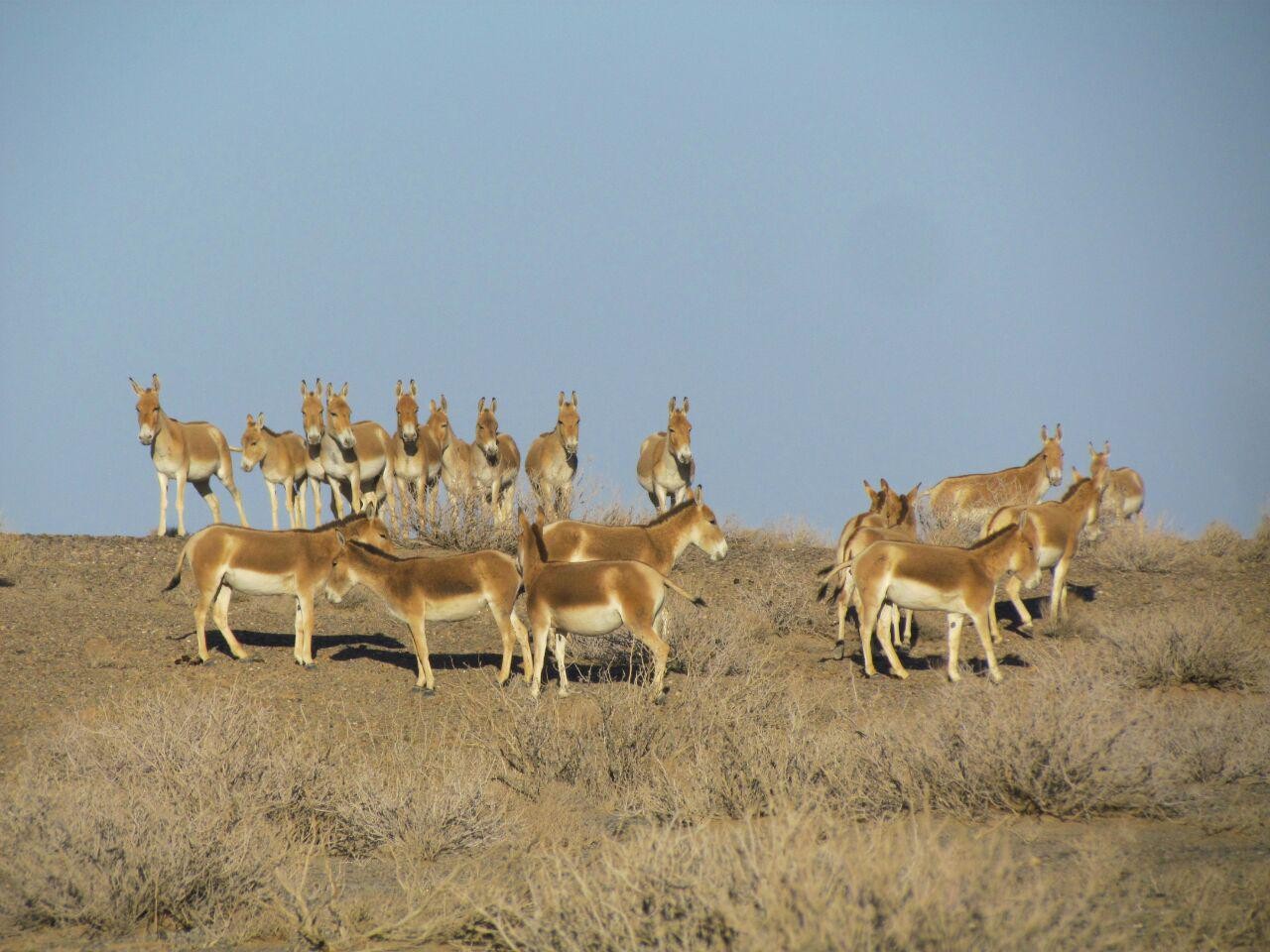
The Miyandasht Wildlife Sanctuary, located in Northern Khorasan and close to the borders of Razavi Khorasan and Semnan provinces, is one of the most critical habitats for the Persian leopard. A vast plain with natural water sources doubles the beauty of this region, attracting migratory birds like flamingos. A male leopard named “Koushki” lives in a 12-hectare fenced area next to the Doshakh base in the Miyandasht Wildlife Sanctuary. Visitors are allowed in this area. Riding through the warm and dry desert route from the Miyandasht Wildlife Sanctuary to the Khar Turan National Park is one of the iconic programs for nature tourism and wildlife conservation.
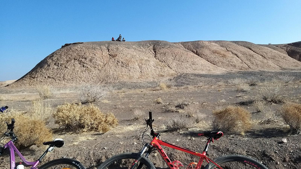
The Miyandasht to Touran route passes through the three provinces of Northern Khorasan, Razavi Khorasan, and Semnan. To access this valuable sanctuary in Northern Khorasan, follow the Esfarayen route on the “Bojnurd – Garme – Shahroud” road. After passing “Andaghan,” take the right exit toward Sorkh Cheshmeh (in the Miyandasht Wildlife Sanctuary). Start your ride on the dirt roads of the town of Sorkh Cheshmeh. Pass through the wildlife sanctuary and reach the City of “Rah Chaman,” located south of the refuge in Razavi Khorasan province. The Joveyn to Jajarm road runs through this village. Continue on this road, and after passing the town of Shafieh Abad, enter the “Jajarm Station Road” from the left exit. Before reaching the City of “Foroumde,” take the right path (toward the City of Firozabad) until you get to the “Shahroud – Sabzevar” road in Semnan province. Ride along this road until Abbasabad.
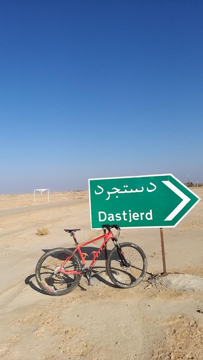
The Abbasabad ranger station, located in the north of Khar Turan National Park, is a suitable place for camping and overnight stays. On the second day, continue your journey south until you reach the lesser-known village of “Kalateh Farhang.” There’s a dirt road (38 kilometers in length) from Abbasabad to Dastjerd. Enter this road and proceed to Dastjerd and the Delbar ranger station (located in the heart of Khar Turan National Park). Delbar is the name of a female leopard living semi-captively in a small fence near Kalateh Delbar. This part of the Khar Turan National Park can be the endpoint of your nature and cycling journey.
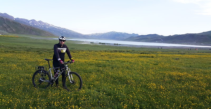
Neor Lake to Talesh Route; Ardabil and Gilan Provinces
- Starting Address: 40 kilometers southeast of Ardabil city, Neor Sofla village
- Route Features: Meadows with abundant flowers and foothill forests
- Type of Route: Dirt road, mountainous and rocky path
- Route Length: Approximately 87 kilometers
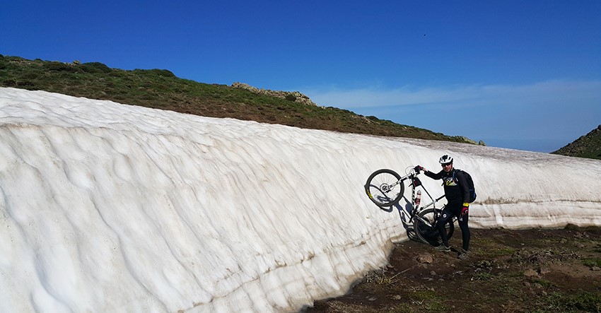
- Route Difficulty: Extremely challenging (6 out of 6)
- Starting Altitude: 2,700 meters above sea level
- Maximum Altitude on the Route: 3,058 meters above sea level
- Best Seasons: Spring and Summer
- Nearest Village to the Starting Point: Neor Sofla
- Nearest City to the Starting Point: Ardabil
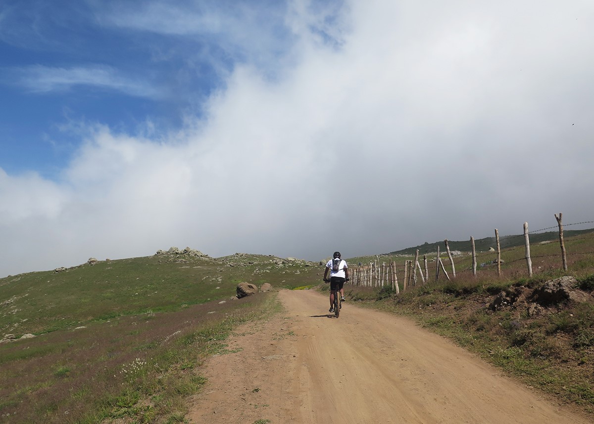
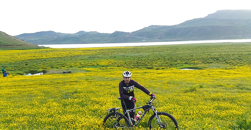
Neor Lake, a natural freshwater lake, is a popular tourist destination between Ardabil and Khalkhal. This beautiful blue expanse covers approximately 210 hectares and has a depth of five meters. The road to the lake is asphalted, with a dirt road encircling it. Fishing, boating, and nature tours are popular pastimes in this pleasant climate. To access the lake south of Ardabil, take the Giwi road. After 35 kilometers, upon reaching the village of “Budalalu,” take the Abbasabad road (left exit). After traveling 13 kilometers on this high road, passing through Abbasabad village, you’ll reach Neor Lake.
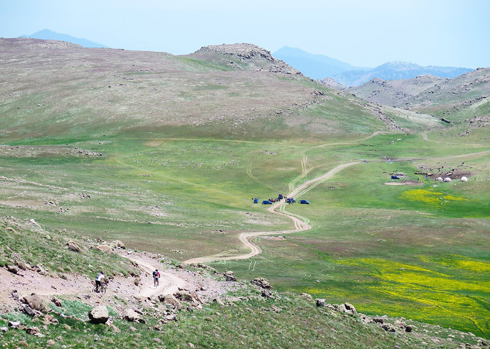
For group cycling from Neor to Talesh, nature tour groups or friend groups load their bicycles on buses during the night. They head to Ardabil and Neor Lake, starting their cycling early in the morning from the starting point. Some even camp beside the lake for a night, enjoying the mountainous nature of the area. This cycling trip takes approximately 21 hours and is typically a two-day program. There are two paths, a mule path and a dirt road, between Neor and Talesh. Most nature and cycling groups choose the mule path, as it’s more pristine and beautiful. There are numerous springs along the way.
Depending on the number of stops, you’ll reach the Soubatan highland either in the noon or evening. Soubatan is a lush, rural area in Talesh County. Wild horses roaming freely, green pastures, gushing springs, roaring waterfalls, wooden huts, and fields of anemones offer a paradise-like view of this natural region. Spend the rest of the day in Soubatan, enjoying its captivating nature. Don’t forget to visit the Varzan waterfall and explore the Soubatan village. You can set up tents in the fields, though accommodations are available for tourists and nature lovers. On the morning of the second day, start your cycling journey towards the City of Talesh. The rest of the route is downhill and approximately 30 kilometers long.
Route from Garmabdar to Baladeh; Provinces of Tehran and Mazandaran
- Starting Address: Shemiran County, Rudbar-e Qasran District, Rudbar-e Qasran Rural District, Garmabdar Village
- Route Features: Expansive plains and green foothills of Alborz
- Type of Route: Mountainous; dirt and rocky roads
- Route Length: Approximately 56 kilometers
- Route Difficulty: Challenging (5 out of 6)
- Starting Altitude: 2,419 meters above sea level
- Maximum Altitude along Route: 3,399 meters above sea level
- Best Season: Spring
- Nearest Village to Start: Abnik
- Nearest City to Start: Fasham
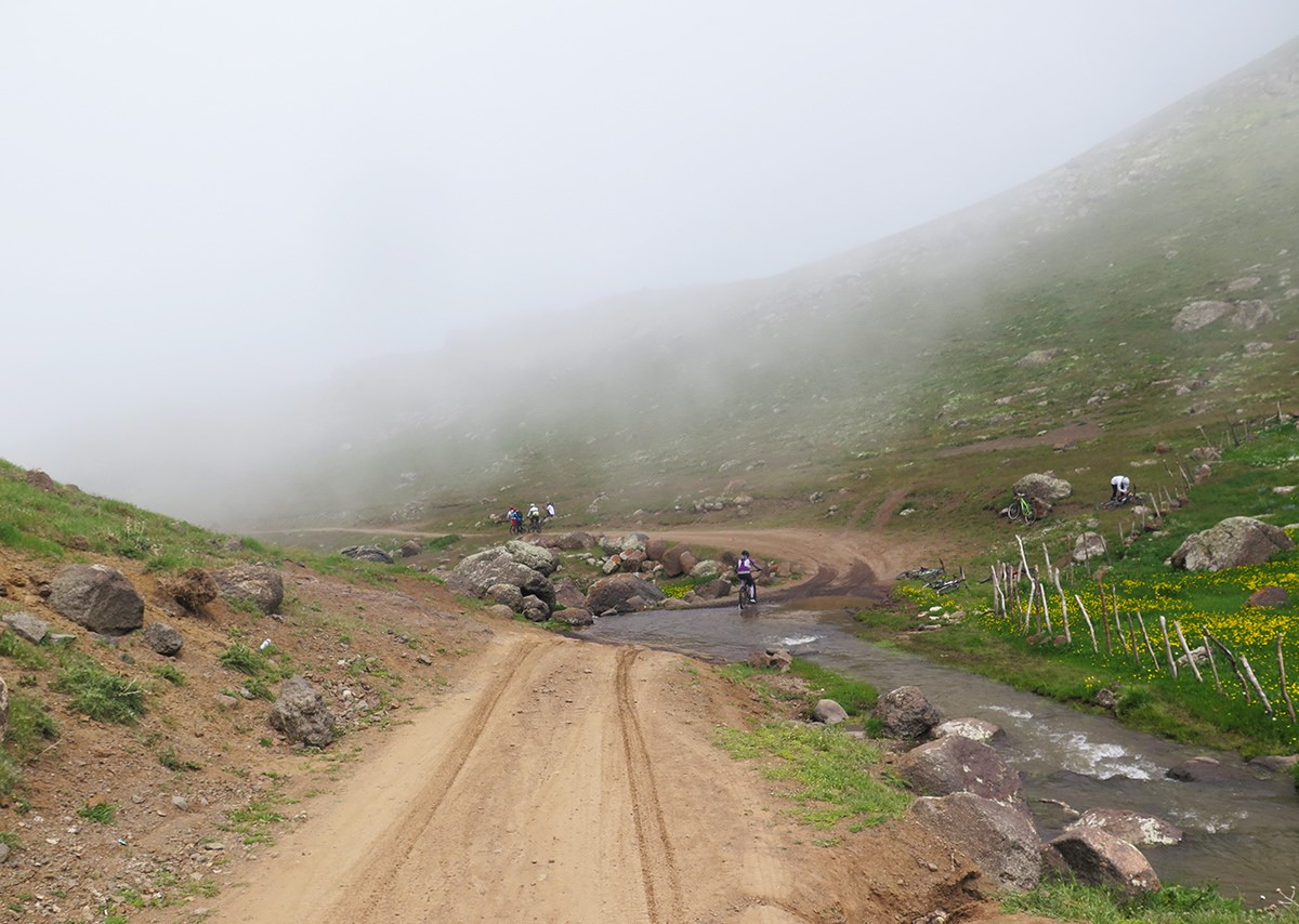
Garmabdar village is located in the northern heights of Tehran province. The protected area of Varjin is situated to the south of the town. The town has a cool climate and beautiful nature. Lashkarak Road in northeastern Tehran is the best access route to Garmabdar. On this road, continue to “Zardband” and then enter the Oshan-Fasham road (Road 425). This road passes by the Jajrood River. Next, crossing east of Fasham, enter the Zaygan road (the western boundary of the Varjin protected area) and continue to reach Garmabdar village. Garmabdar’s environmental station (at the eastern end of the town) marks the beginning of the three-day horse-riding trail to Bangladesh. Before starting the trip, obtain a permit from the Tehran Province Environmental Department. You can traverse the route from Garmabdar village to Khatun Bargah Pass with a Nissan. A dirt road, relatively suitable for cars, exists up to the vicinity of the “Khatun Bargah” Pass. You can also traverse this part of the route with a Nissan.
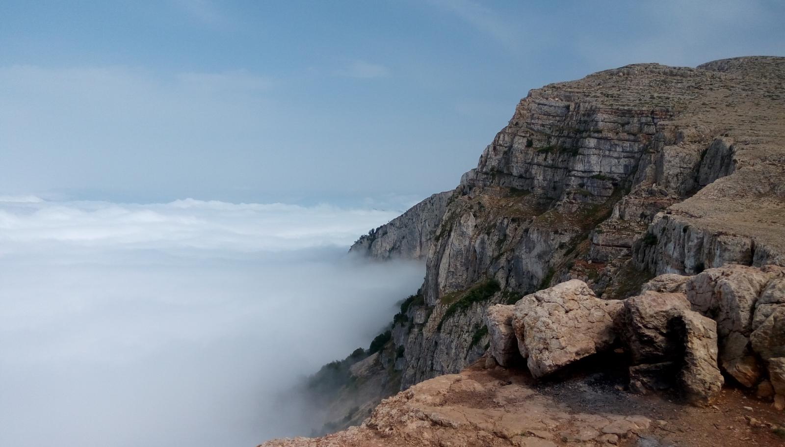
On the first day, reach the pass. This area is located approximately 3,000 meters above sea level and is often among clouds. Camping overnight at Khatun Bargah Pass is very dreamy, and in the morning, you will wake up amidst a massive fog-like mist. The view of the high peaks of Central Alborz once again reminds humans of the grandeur of God. On the second day, continue your journey through the old and rugged road of the pass and horse-ride towards Dasht-e Lar (from the Yunza strait). Many rough patches along the way (especially during the rainy seasons) are impassable alone and without a mountain bike. If you visit the area in late spring or early summer, you will surely meet the nomads of Dasht-e Lar. Continuing the horse-riding journey from Garmabdar to Baladeh, you must cross the vast and full Lar River to reach the Sefidab waterfall (or Qoo waterfall). After crossing the vast Lar plain, you must pass through the “Pakbood” pass. After the key, the Koushk valley is located. A challenging and rough route connects this valley to the “Chehel Cheshmeh” plain. Camp the second night in this plain. On the third day, after crossing the full river several times and passing through a rugged route, you will reach the dirt road of Yalroud village. Next, enter the asphalt road (seven kilometers long) from Yalroud to Baladeh village. Baladeh village, located in the Nour county and Baladeh district, is the final destination of this challenging horse-ride. The untouched and scenic nature of Baladeh is one of the tourist attractions of Mazandaran province.
Route from Tafresh to Saveh, Markazi Province
- Starting Address: Tafresh County, Tafresh Road, beginning of Kohandan exit (junction of the old Tafresh to Tehran road), Abdullah pass.
- Route Features: Passing through the heart of beautiful villages and orchard alleys.
- Route Type: 25 kilometers of dirt road and 35 kilometers of asphalt road with downhill and uphill stretches.
- Route Length: About 60 kilometers.
- Route Difficulty: Easy (2 out of 6).
- Starting Elevation: Approximately 2,507 meters above sea level.
- Maximum Elevation on Route: 2,704 meters above sea level.
- Best Seasons: Autumn and Spring.
- Nearest Village to Start: Abdul Abad Payin.
- Nearest City to Start: Tafresh.
The route from Tafresh (Abdullah pass) to Saveh (Saveh road, Qahan junction) is one of the beautiful biking trails. Both the starting and ending points of this trip are located in Markazi Province. This program is a day-long journey, and its characteristics include passing through untouched and beautiful villages and pristine orchards. The starting point for biking is near the southeast of Tafresh city (Abdullah pass). Follow the Tafresh road to reach the key. Prepare your bicycles at the beginning of the route, and with your fellow bikers, set off on the secluded dirt road of the key. The initial way is uphill for about five kilometers. Next, as you pass the steep slopes of the old Kohandan pass, springs, local orchards, and lush, tree-filled landscapes, you’ll reach Kohandan village. The distance from the starting point to this village is about 15 kilometers.
Continue your journey from the northeast of Kohandan village, and after about three kilometers, you’ll arrive at “Vanan” village. This part of the route is downhill and is covered quickly. The dirt road north of Vanan leads to the green town of “Nayes.” There are beautiful sceneries along the route, perfect for photography and memory recording. During this journey, you can also visit the towns of “Anjileh” and “Kasava” located west of Nayes village. The spring water and the four Sassanian arches northwest of Nayes village are also great biking destinations, and visiting them will enrich your journey. If you start your trip early in the morning, you’ll pass through this area by noon.
Continue on the northeast road from Nayes village. There’s a full pond next to the dirt road, suitable for resting and having lunch. Next, you’ll reach the Qahan town. After passing through Qahan, head towards the Saveh road. You can continue biking to Saveh. During the autumn, there are active pomegranate sale stations and related products along the route.
Route from Roodbar to Dorfak; Gilan Province
- Starting Address: Roodbar County, Rahmat Abad and Boloukat District, Dashtool Sub-district, Si Dasht Meadow
- Route Features: Steep and challenging ascents, excellent mountain views
- Type of Route: Dirt road, mountain and rocky paths
- Route Length: Approximately 22 kilometers
- Route Difficulty: Difficult (6 out of 6)
- Maximum Elevation on the Route: 2,545 meters above sea level
- Best Season: Spring
- Nearest Village to Starting Point: Si Dasht
- Nearest City to Starting Point: Tootkabon
Mountain biking from Roodbar (Si Dasht Meadow) to Dorfak (Dorfak Peak) is a program for tireless and professional bikers, so step onto this path fully prepared. Si Dasht Meadow is a pleasant and tourist-friendly area in the northeast of Roodbar County, recognized by mountain bikers as the starting point for biking to Dorfak. To reach this meadow, enter the Qazvin-Rasht road. After passing Roodbar, take the Tootkabon to the Bereh Sar exit. Right after the Dashtovil petrol station, leave on the left side of the road (Polang Darreh Road). After Deferaz and Polang Darreh, you reach Si Dasht Meadow. Park your vehicle safely, and prepare your bikes for a challenging and adventurous route.
Conquering Dorfak Peak by bike requires high skills and physical readiness. Begin your ride from Si Dasht to Dorfak Peak from the dirt and forest road of “Kerf Kool” Park, located southeast of Si Dasht village. Passing through “Noral Arsh” and “Naveh,” you reach a crossroad. Continue on the left path. After “Siah Dasht Bon,” enter the Dorfak Chichal road (Delfak’s climbing side road). When you reach the Chichal exit, continue straight and enter the Dorfak Khorgam communication road. This road will lead you to Dorfak Peak. This majestic peak is located in the no-hunting zone of Dorfak and Khorgam, and athletes climb it from various sides. Dorfak, or Delfak, is a dormant volcano in the Western Alborz mountain range. For the return, a 20-kilometer downhill route awaits you.
Route from Tehran to Dasht-e Lar; Tehran and Mazandaran Provinces
- Starting Address: Roodbar-e Qasran District, Garmabdar Village
- Route Features: Crossing flower-rich and green plains
- Type of Route: Dirt road, mountainous area
- Route Length: Approximately 60 kilometers
- Route Difficulty: Medium (3 out of 6)
- Starting Elevation: Approximately 2,419 meters above sea level
- Maximum Elevation on the Route: Approximately 3,200 meters above sea level
- Best Season: Spring and Autumn
- Nearest Village to Starting Point: Garmabdar
- Nearest City to Starting Point: Roodbar-e Qasran
Mountain biking in Dasht-e Lar is a popular activity among mountain bikers. Many biking tours select the village of Garmabdar in the northeast of Tehran province (near the border of Mazandaran province) as the starting point for this journey. Begin your ride early in the morning from the dirt road east of the village. Follow along the stream until you reach a crossroad. Choose the right path. A winding road lies ahead of you. Pass by Sorkh Cheshmeh until you reach the intersection at Yoonza Pass. Continue straight on your route. Keep on the high dirt road up to the Khatoun Bargah Pass. About five kilometers after the pass, you’ll need to cross a river.
Continue eastward on your path to enter the Lar National Park. The service road and the river in Dasht-e Lar are your guides throughout the journey. Next, pass over the Lar River and “Sefid Ab” (White Water). Ride along the Lar River until you reach a spring and, ultimately, the Lar Dam Lake. Before reaching the lake, you’ll pass by a shrine. You can direct yourself to the ranger station on the north side of the Lar Dam Lake. About two kilometers after the ranger station, you’ll reach the asphalt road of the dam. This road leads to Polour and Haraz Road.
Route from Karaj, Atashgah, Barghan, to Kordan; Alborz Province
- Starting Address: Haft-e Tir area of Karaj, Mowzoon Boulevard
- Route Features: Scenic, passing through villages, alongside rivers, and tree-lined paths
- Type of Route: Dirt and asphalt roads
- Route Length: Approximately 36 kilometers
- Route Difficulty: Medium (3 out of 6)
- Starting Elevation: 1,451 meters above sea level
- Maximum Elevation on the Route: Approximately 1,963 meters above sea level
- Best Season: Spring and Autumn
- Nearest Village to Starting Point: Siah Kalan
- Nearest City to Starting Point: Karaj
Cycling from Atashgah in Karaj to Barghan is a joint program among cycling groups in Karaj and Tehran. This route is not very challenging for enthusiasts of the sport. To start this journey, navigate the various ways in Karaj, mostly uphill, to the Gohardasht neighborhood and Mowzoon Boulevard. Move alongside the Islamic Azad University and Rajai Shahr Prison until you enter Atashgah Road of Karaj. Before reaching Atashgah village, get onto the Barghan road (to the left). The route to the entrance of Barghan Road is uphill and steep. The direction toward Barghan is downhill, and the area is situated in a valley. The valley and Barghan village, nestled among the colorful mountains, host numerous tourists daily.
Ride on the Barghan road until you reach Barghan village. At the beginning of the town, you must cross over a river via a brick bridge. The cobblestone alleys of Barghan lead you through winding paths to the main square of the City, Ghareeshi Square. Fresh local bread, Barghan’s plums, walnuts, and organic dairy products are the local specialties of this mountainous village. Move from Barghan towards Kordan. This part of the route goes alongside a river. Enjoy your breakfast in the pristine environment surrounding Barghan Village. The area is calm and tree-filled, but be cautious of passing vehicles.
The Barghan-Kordan road takes you to Kordan village (in Savojbolagh County) and your final destination. Upon arriving in the town, enter the Boulevard of Kordan Martyrs. Pass the Kordan bridge and continue on the old Chaharbagh road until you reach the old Qazvin road. On this road, passing through Kamalshahr, you will arrive at Shahid Beheshti Street in Karaj. This is a light, half-day program, taking approximately 6 hours.
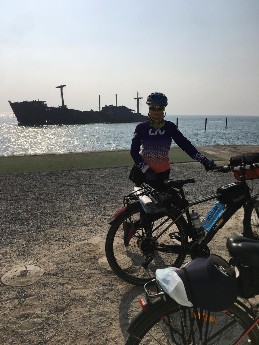
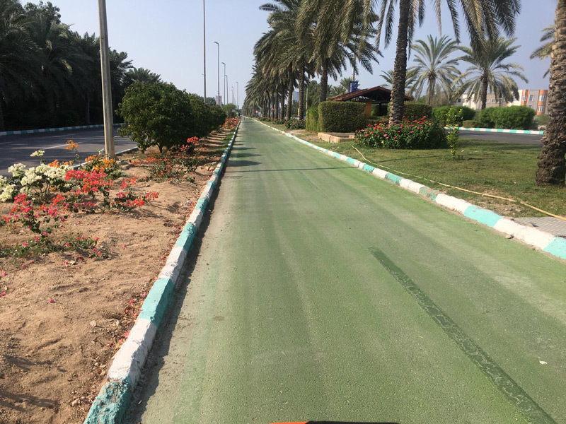
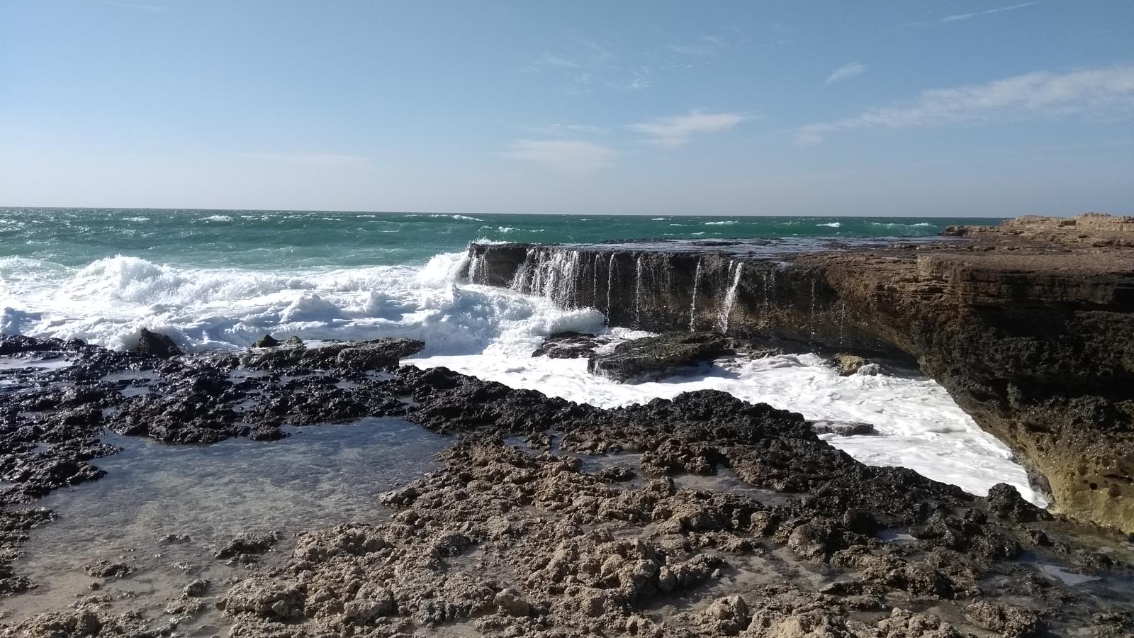
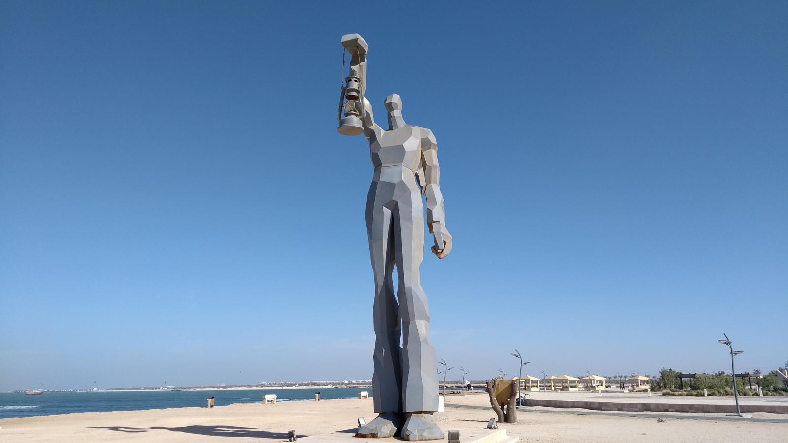
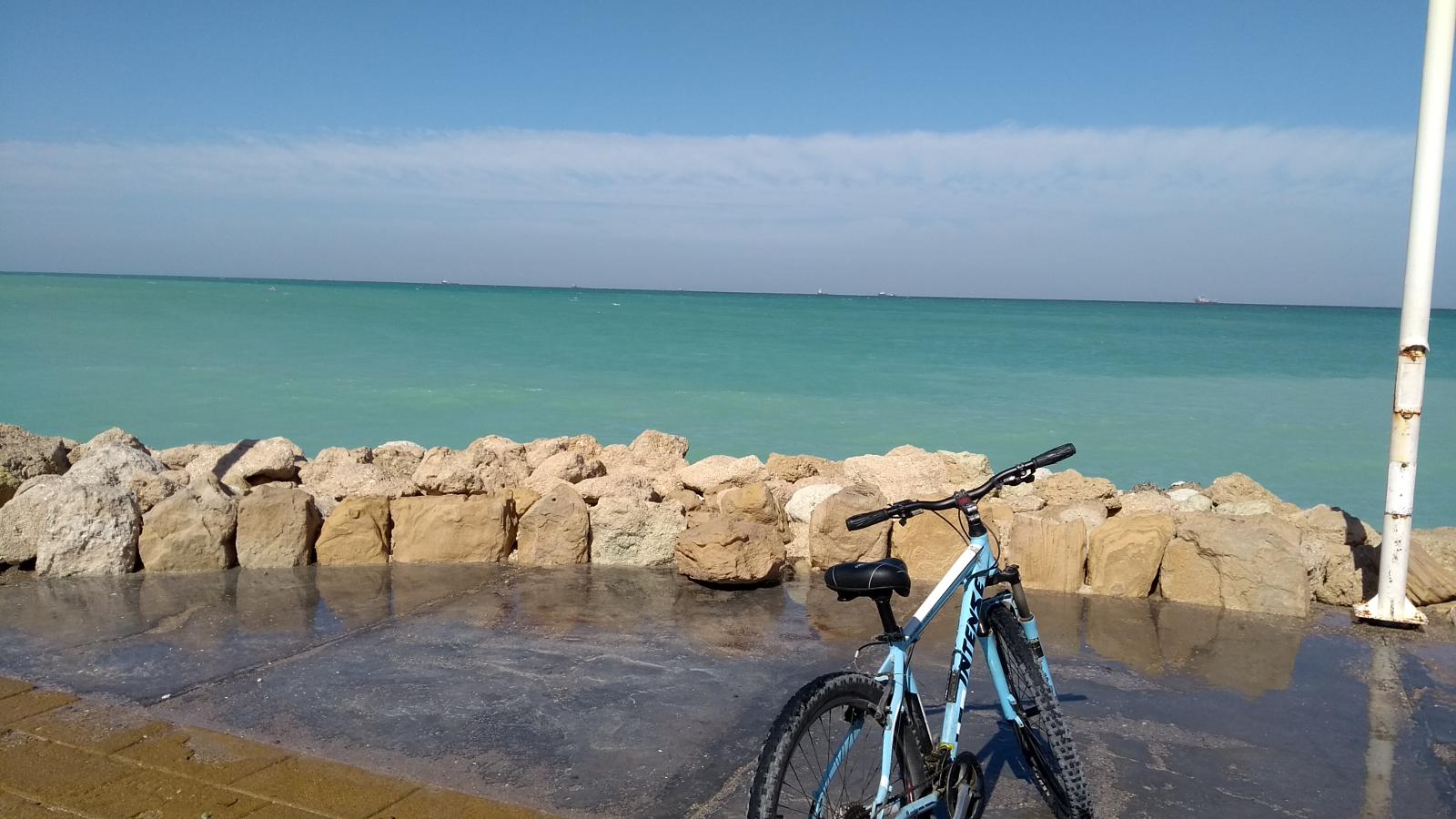
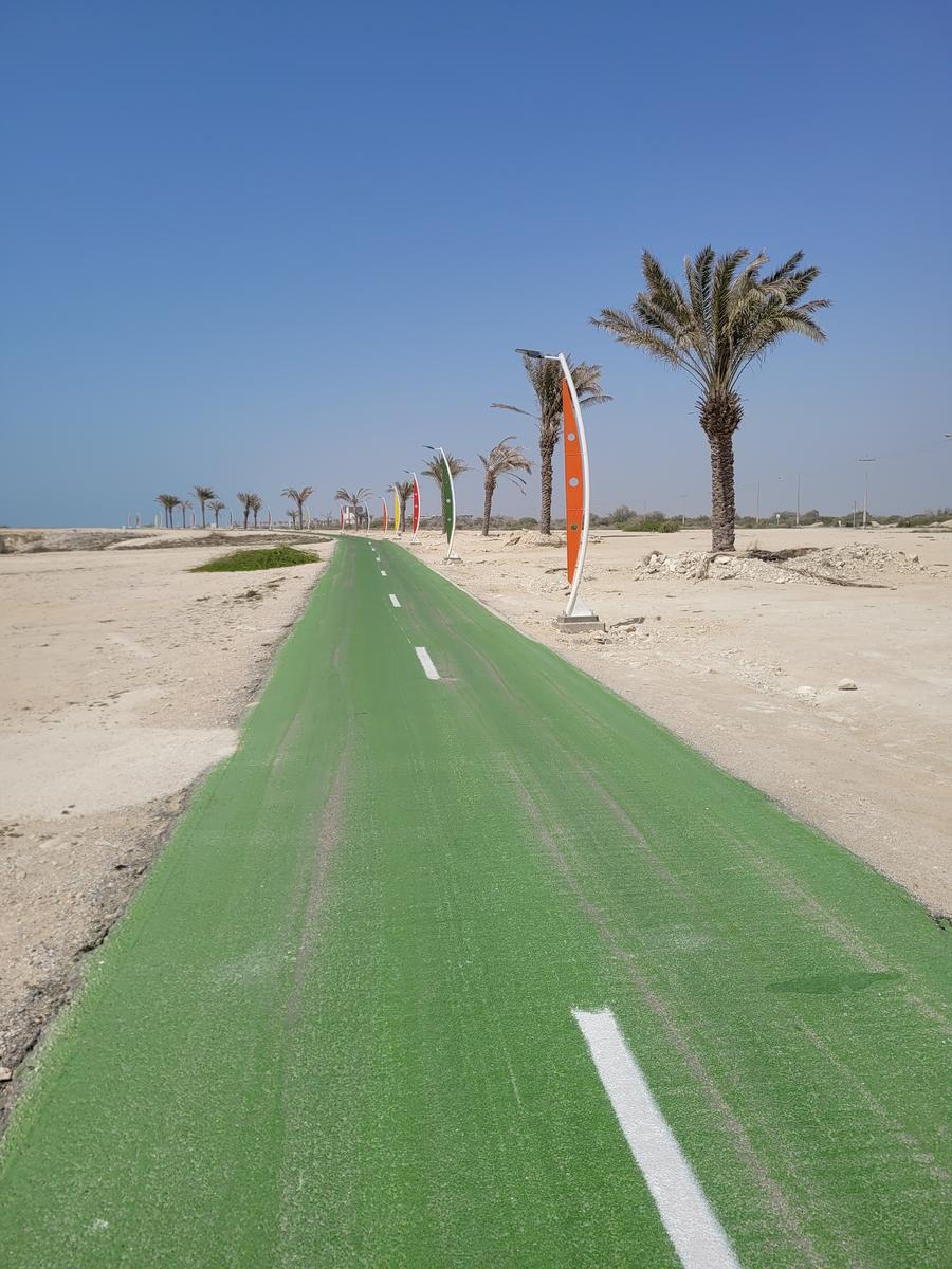
Bike Route of Kish Island
- Starting Address: Kish Island
- Route Features: Ocean views and coastal line travel
- Type of Route: Asphalt road dedicated to cyclists
- Route Length: Approximately 75 kilometers
- Difficulty Level: Easy (2 out of 6)
- Starting Elevation: Sea level
- Best Season: Spring and Autumn
The bike path on Kish Island is approximately 75 kilometers long. The municipality of Kish, with meticulous and outstanding planning, was able to construct it. Over the past few years, they have renovated various sections and added new parts, making it more comprehensive. This route is not just around Kish Island, contrary to the initial idea. Parts of it extend into the City, and we’ll likely see even more of the route penetrating urban pathways in the future.
The cycling route around Kish Island runs along the boulevard known as Boulevard Jahan, which is the coastal boulevard of Kish Island. It’s essential to understand that some people think this route is a straight line throughout its length. However, the bike path on Kish Island winds through different sections around the island, including the City, parks, villages, and more.
If you intend to venture into the City during your bike journey on Kish, you should direct yourself towards Jask Square, located after the Mir Mahna sports complex. After passing the sports complex, enter the first side branch. This route will lead you into the urban area. Then, by entering Jask Boulevard, Mir Mahna, and Iran, you can return to the main path of Boulevard Jahan and cycle around Kish Island. Therefore, it’s recommended to familiarize yourself with the entire route to enjoy its attractions fully.
Exploring Iran
Special Tours to Iran for English Speakers
in your
Native language